Francine will bring ‘significant to life-threatening impacts’ to MS Coast, forecasters say
READ MORE
Hurricane Francine
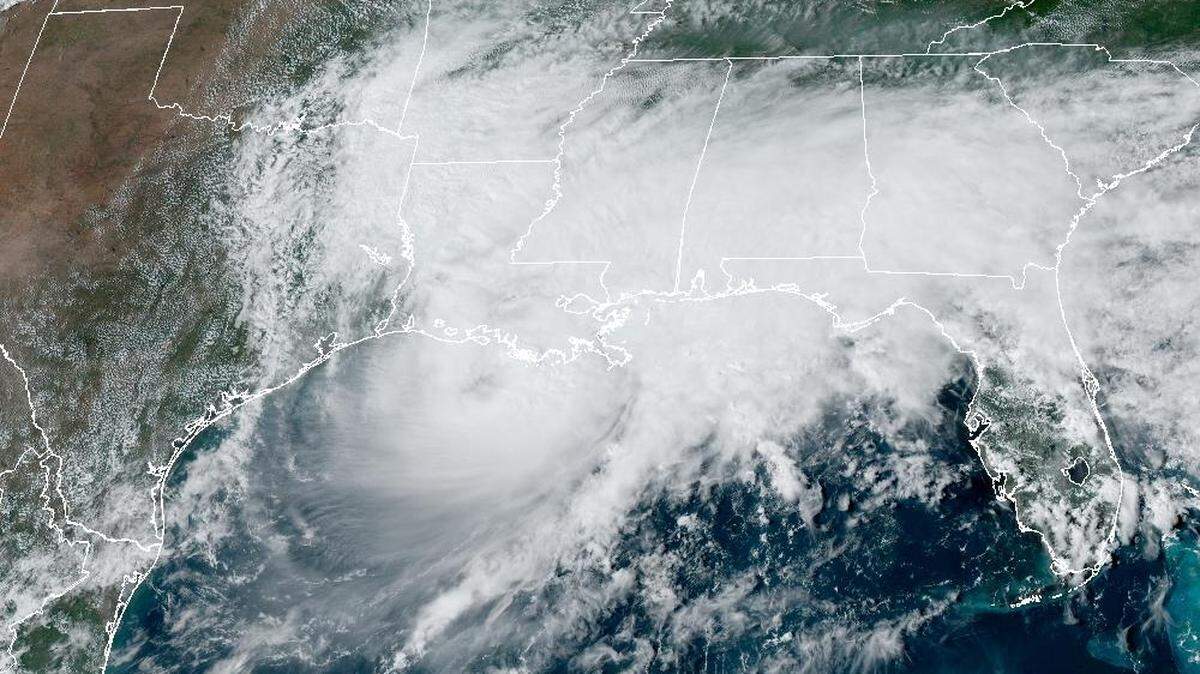
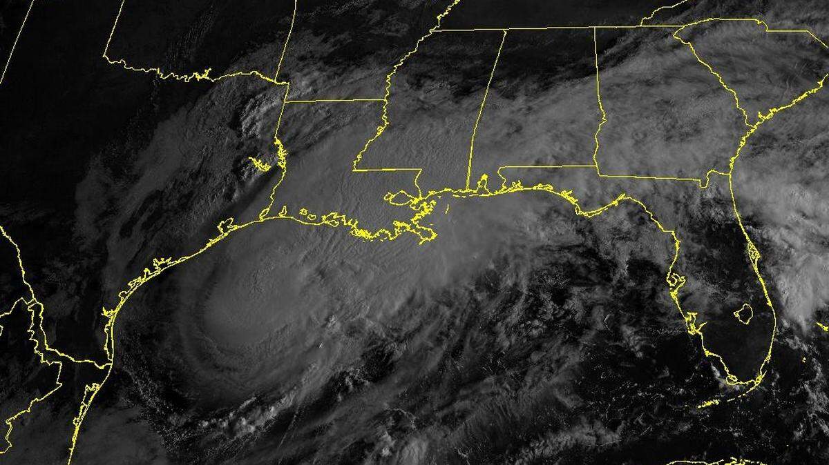
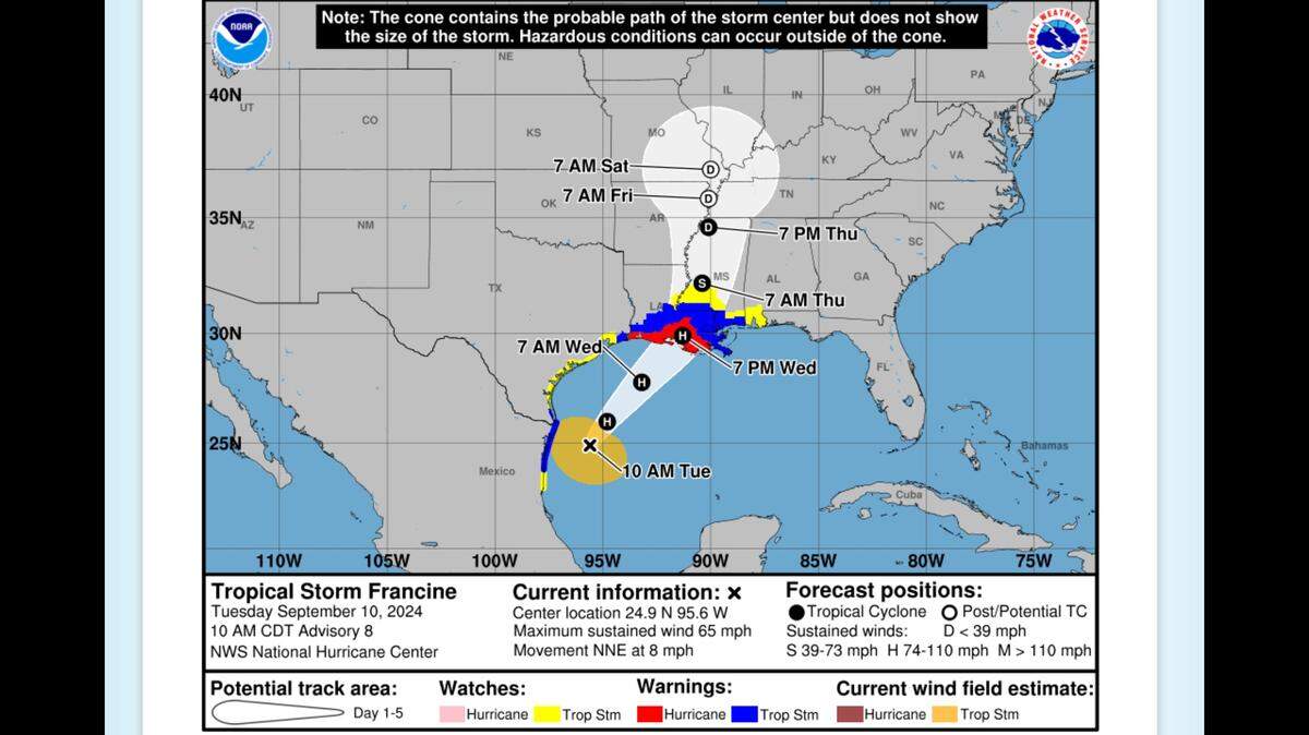
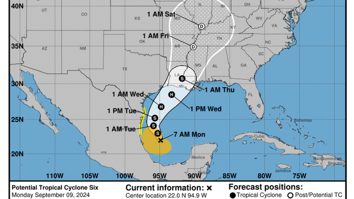
Francine is expected to make landfall Wednesday as a Category 1 hurricane. While the storm appears headed to the Louisiana coast, Southern and coastal Mississippi could see a risk of flash flooding, according to the National Weather Service.
Expand All
▪
NOTE: This story has been made available for free, for all readers. Please consider supporting local journalism through the purchase of a digital subscription.
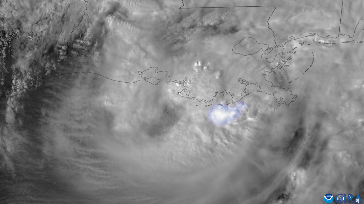
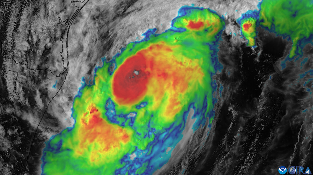
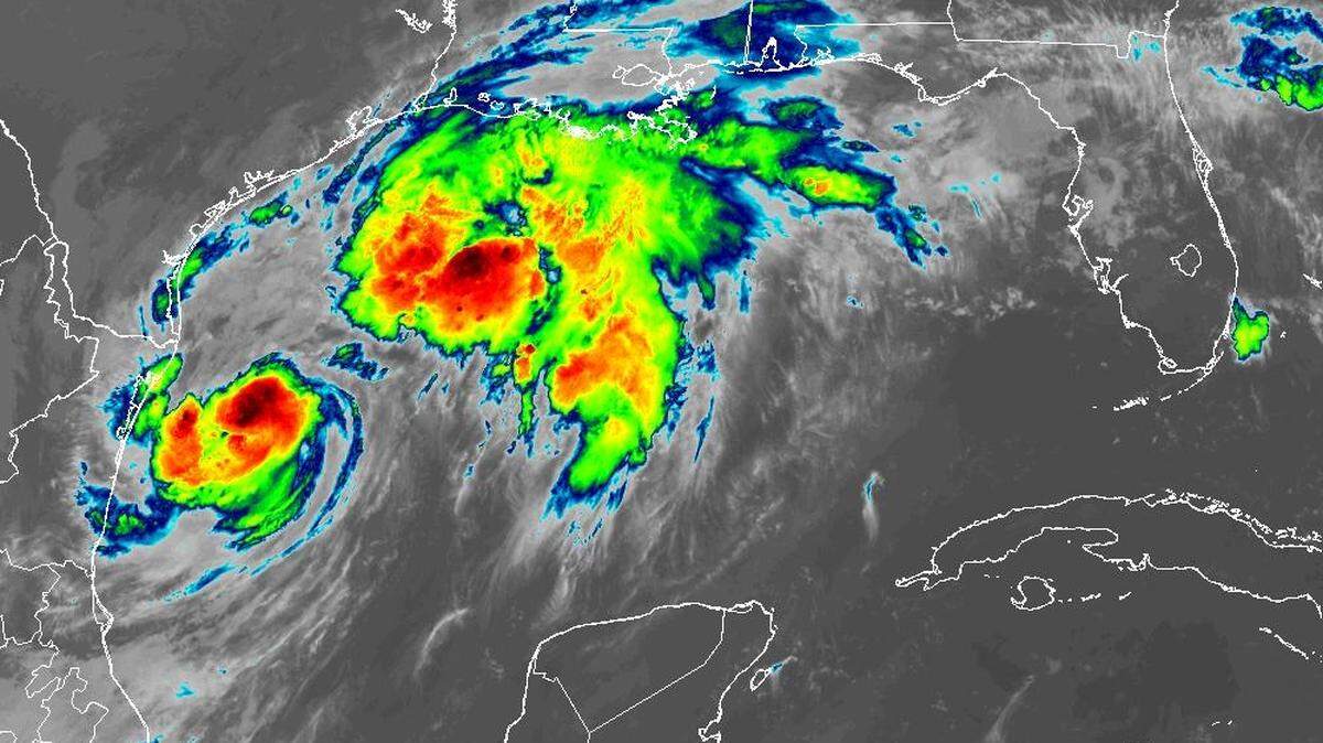
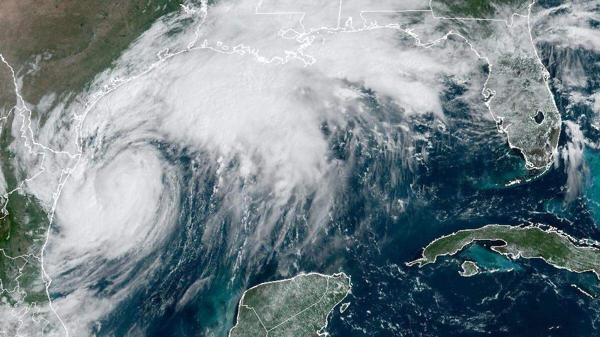
Dry air and wind shear are expected to slow intensification of Hurricane Francine as it tracks southeast toward Louisiana’s shore, leading the National Hurricane Center to forecast landfall as a Category 1 hurricane as opposed to Category 2.
The hurricane center said in its last Wednesday night update that Francine has a “well-organized core” with significant strengthening likely through Wednesday morning while it remains over “very warm waters” with low wind shear. The hurricane was just at Category 1 status, which is 74 to 95 mph.
The forecast shows Francine reaching 90 mph at landfall.
“A notable increase in shear and intrusions of dry air should end the opportunity for strengthening just before Francine reaches the coast,” the latest hurricane center update said.
The hurricane’s impacts will be felt along the Louisiana and Mississippi coastlines in less than 24 hours, the National Weather Service says. Francine is expected to make landfall Wednesday afternoon or evening in Louisiana, rapidly weakening inland as it moves northward Wednesday night and Thursday into Mississippi.
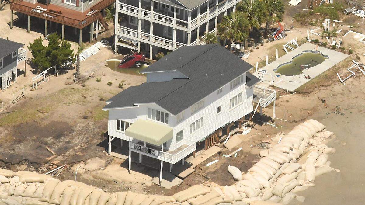
“We are VERY CONFIDENT this storm will bring significant to life-threatening impacts to portions of southeastern Louisiana and southern Mississippi,” a bulletin from the National Weather Service said early Tuesday evening.
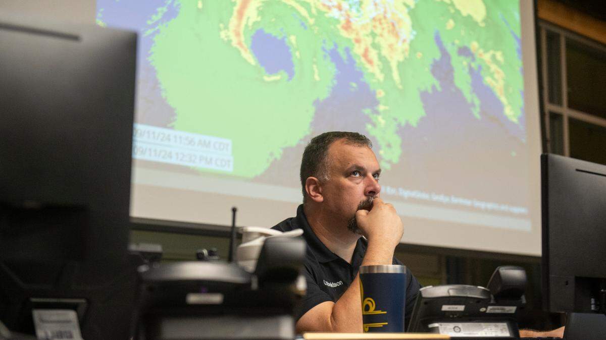
Meteorologist Kevin Gilmore of the weather service for New Orleans/Baton Rouge described the impediments to Francine’s intensification during a Live video on the agency’s Facebook page.
“We’re still going to get a lot of rain and wind from this system,” Gilmore said. “There’s definitely going to be some hazards, regardless. The system’s not going away. It’s not going to halt and turn around or anything like that.”
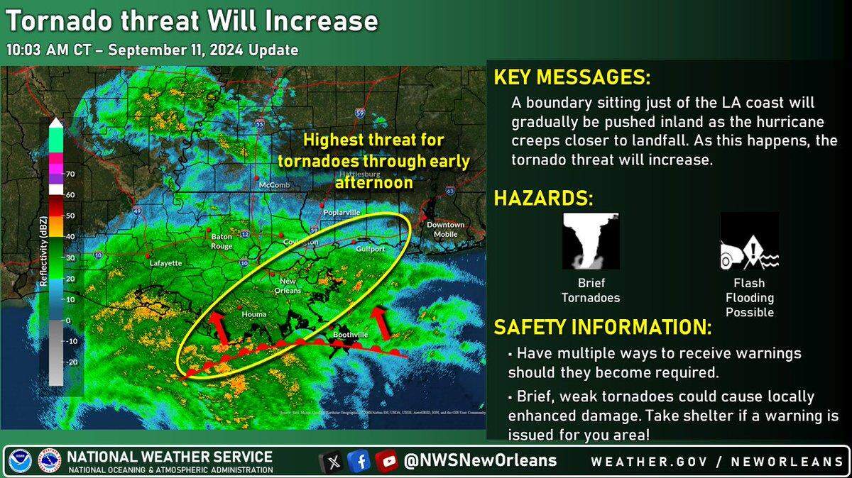
Gilmore said residents will experience high winds, flash-flooding from rain, coastal flooding from storm surge and tornadoes tomorrow through Thursday morning.
Francine packs wind, rain, surge
By 7 p.m., Tuesday, the hurricane center said, Francine’s maximum sustained winds had increased to almost 75 mph, with higher gusts. Strengthening is expected through Wednesday morning.
Hurricane-force winds extended up to 35 miles outward and east of the center, with tropical-storm-force winds stretching 115 miles from the center.
The track has nudged slightly eastward. A hurricane warning remains in effect for portions of southern Louisiana, with a storm-surge warning for both the Louisiana and Mississippi coastlines. South Mississippi’s lower six counties are under a tropical storm warning.
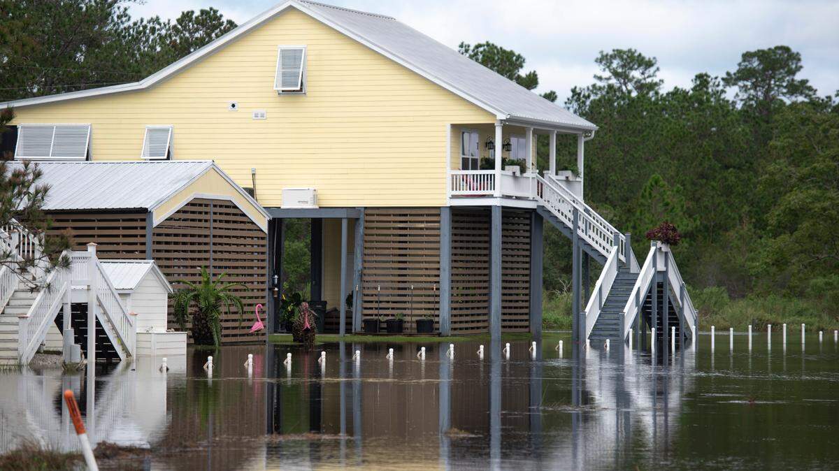
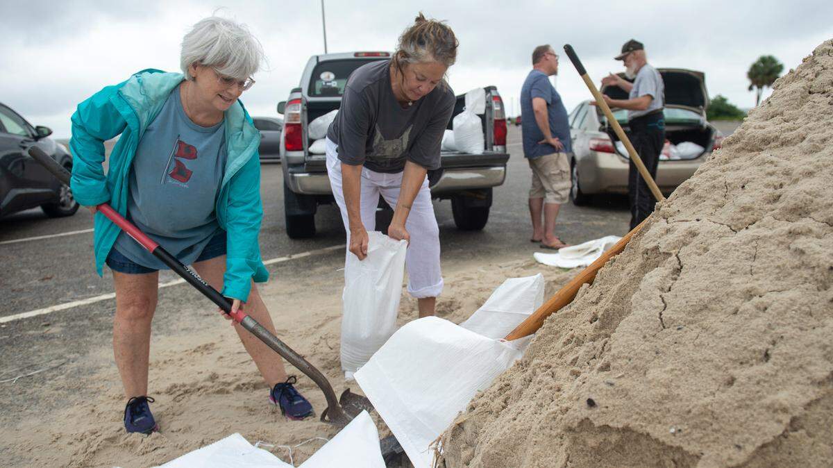
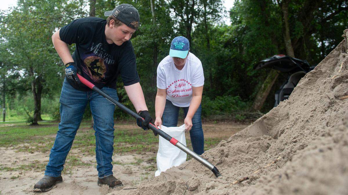
As the track moved east, Hancock County issued a voluntary evacuation order Tuesday afternoon for low-lying areas. The county’s emergency management director, Brian “Hooty” Adam, expects most of the storm’s impact from surge and flash-flooding.
“It’s going to put a good amount of water on the road,” Adam said Tuesday night. “Fortunately, most of the houses are up on pilings.”
Here are the main impacts South Mississippi residents can expect from Francine:
- Tropical storm-force winds of up to 60 mph in southwestern Mississippi, including the extreme western portion of Hancock County. Moving east, winds are expected to hit 30-50 mph in the southernmost counties, including Harrison and most of Jackson. Near the Alabama line, winds should be below 30 mph. Tropical storm strength winds are 39-73 mph.
- Storm surge of up to 6 feet from state line to state line along the Coast.
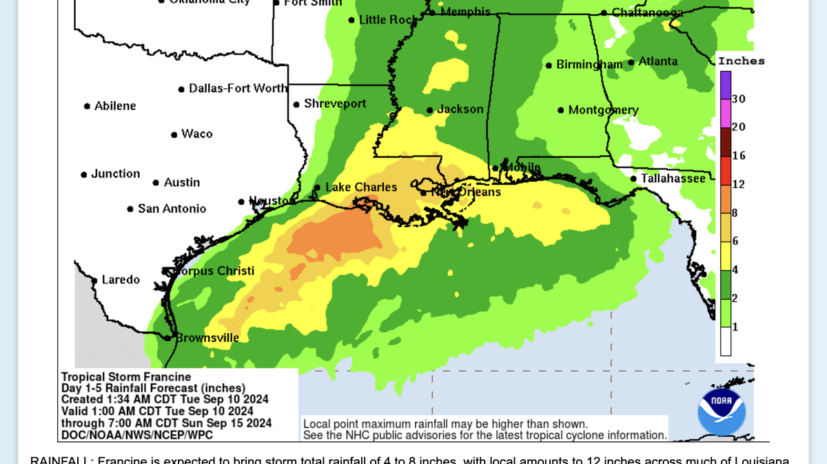
- Rainfall of 4-8 inches, with up to 12 inches in some areas. Record-high moisture in the air will feed thunderstorms. Gilmore said rain will continue Tuesday night through Thursday morning. Gilmore expects rainfall to increase as Francine approaches land.
- Tornadoes could touch down, Gilmore said, especially to the east and right of Francine as outer rain bands come ashore. Water spouts could form, too.
This story was originally published September 10, 2024 at 7:20 PM.