Francine could unleash storms & floods across MS after landfall. See statewide forecast
READ MORE
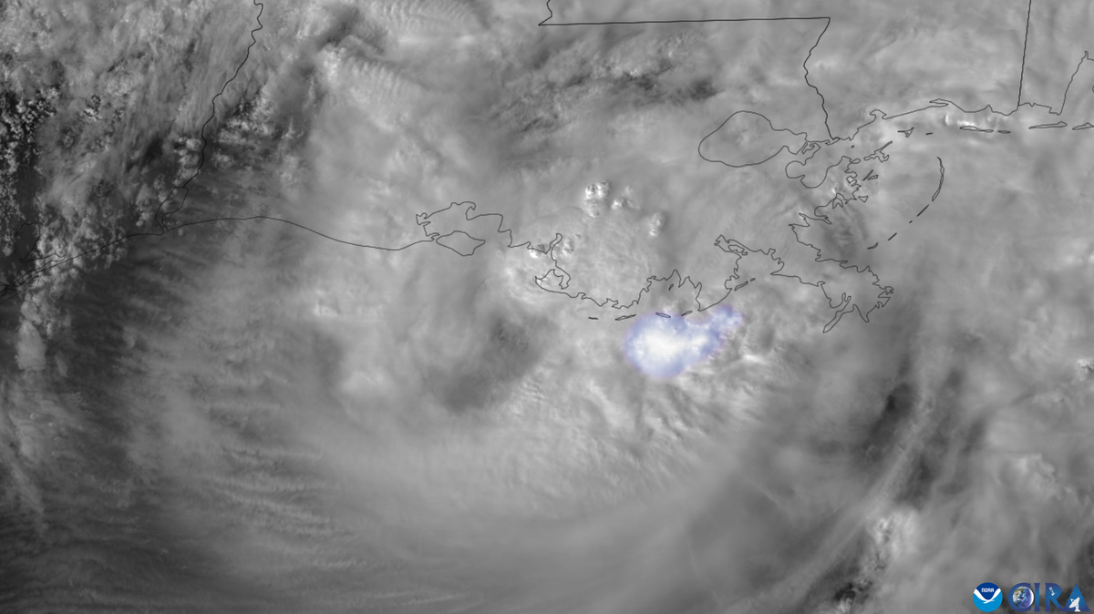
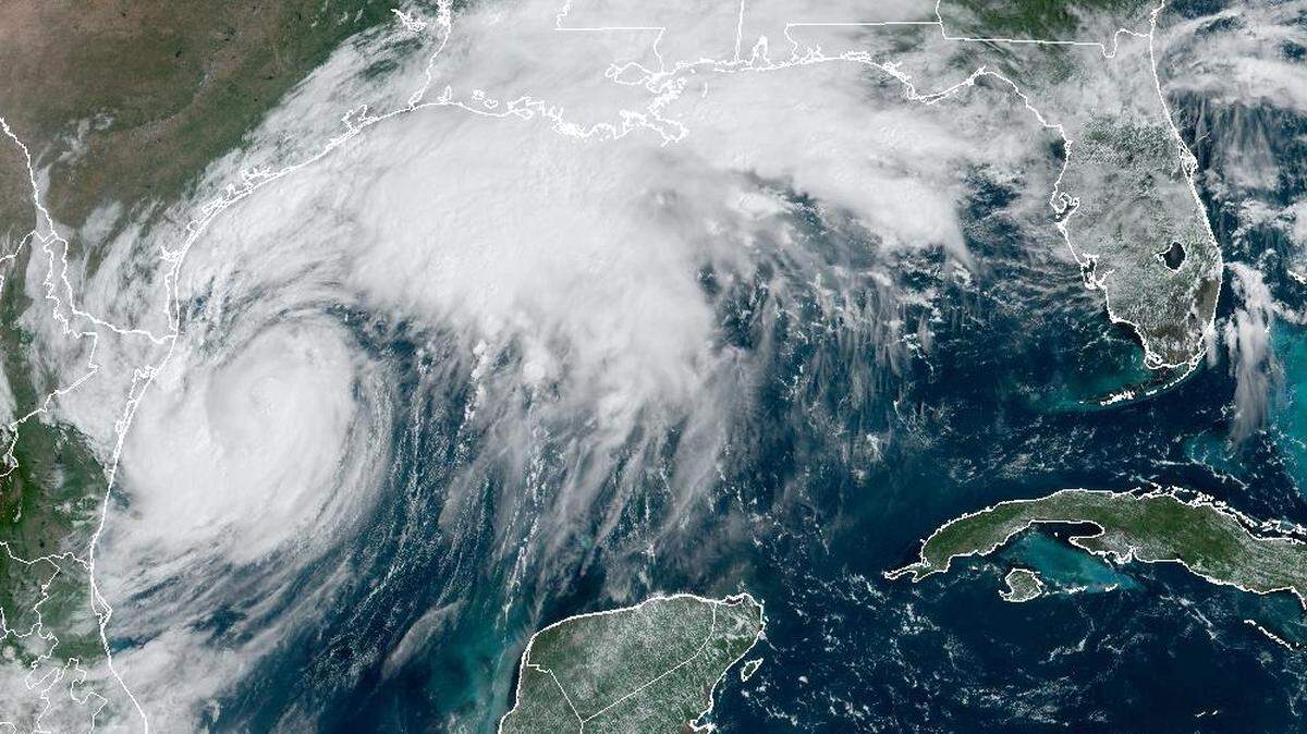
Hurricane Francine
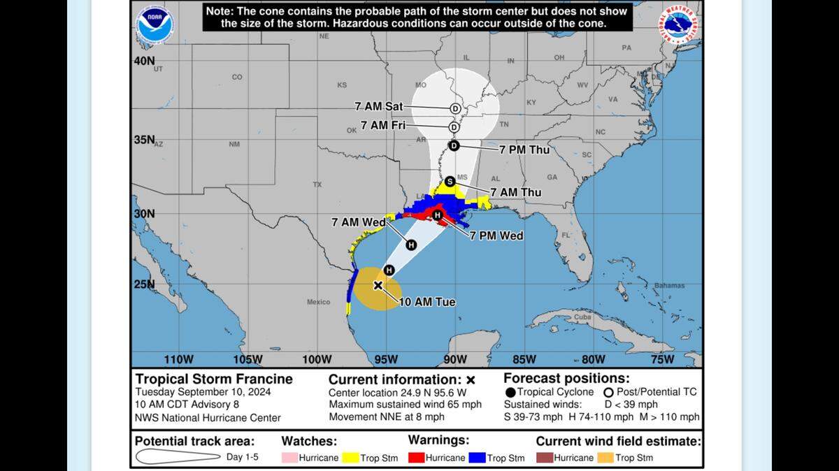
Francine is expected to make landfall Wednesday as a Category 1 hurricane. While the storm appears headed to the Louisiana coast, Southern and coastal Mississippi could see a risk of flash flooding, according to the National Weather Service.
Expand All
NOTE: This story has been made available for free, for all readers. Please consider supporting local journalism through the purchase of a digital subscription.
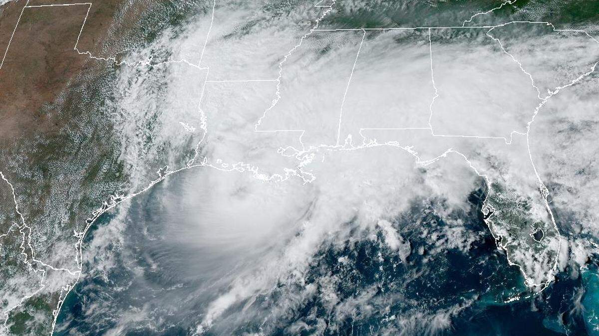
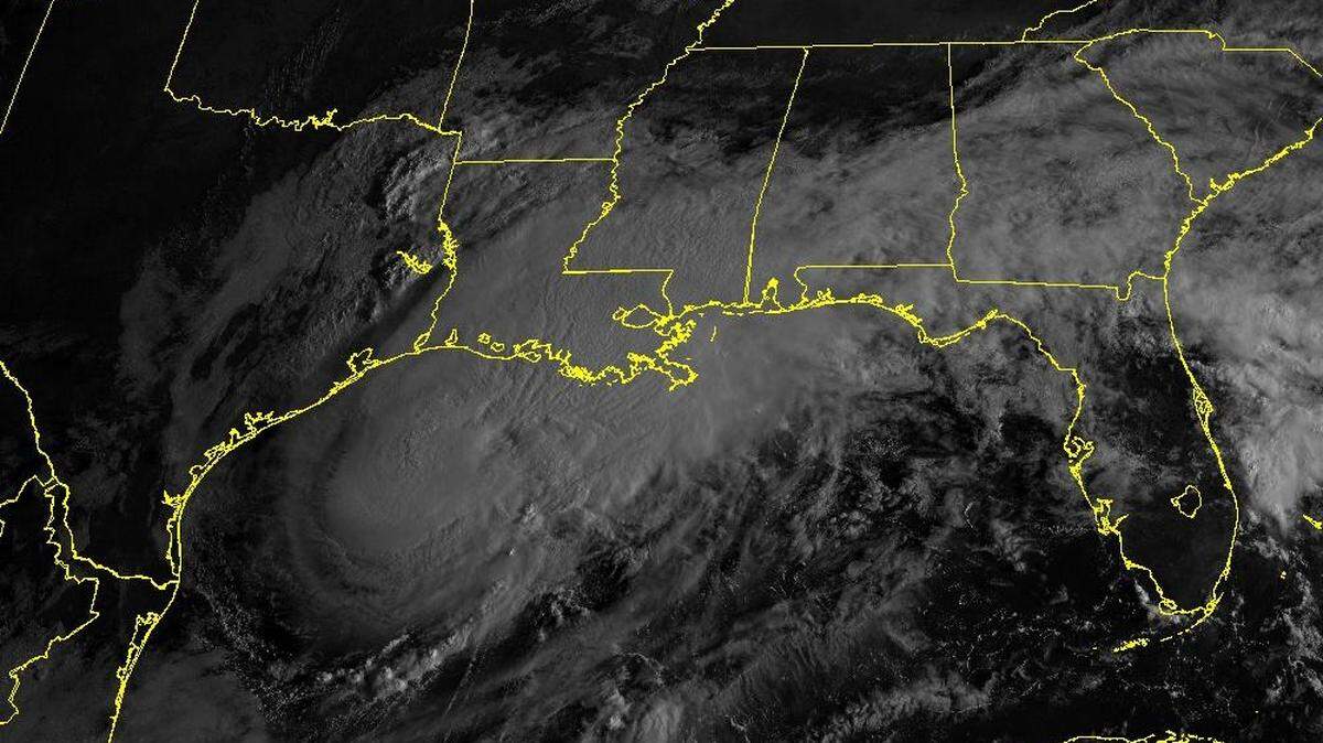
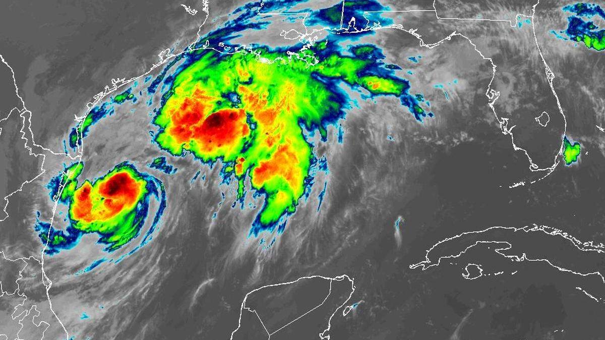
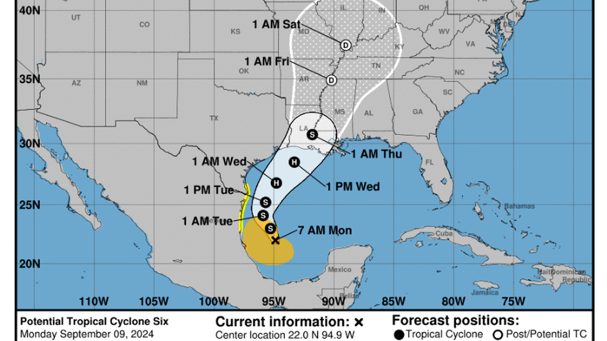
Tropical Storm Francine will strengthen to a hurricane this week and charge through Louisiana and Mississippi with pounding winds and heavy rains, forecasters said. The central Louisiana coast may bear the brunt, but southwest, central and coastal Mississippi could face flash flooding and isolated tornadoes on Wednesday as the tropical system churns north.
The National Weather Service in Jackson warned of a barrage of rain, flash flooding, severe storms and gusty winds. The highest risk will come Wednesday and Thursday, when the storm makes landfall in Louisiana and barrels inland. Francine is expected to track through southwest and central Mississippi and could pass through the Mississippi Delta as a weakening tropical system on Thursday.
In Mississippi, the southwest region and the Coast appear most at risk. Wilkinson, Amite, Pike and Walthall counties in the southwest corner of the state are under a tropical storm warning. Much of southwest Mississippi, including Natchez and Brookhaven, is under a tropical storm watch.
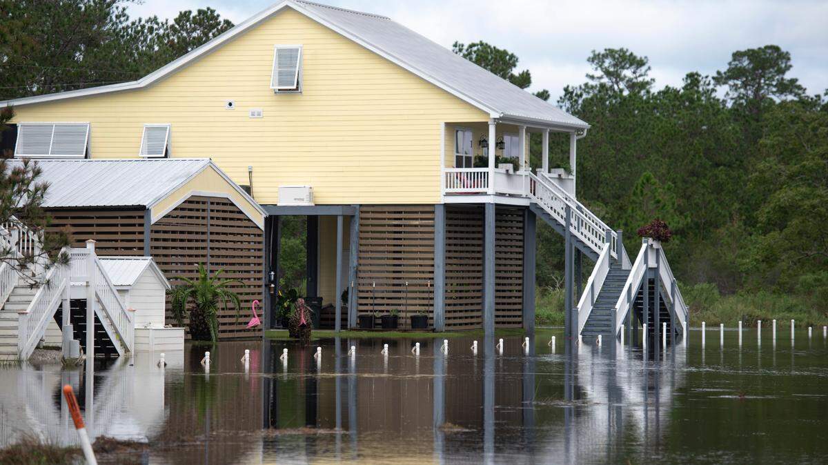
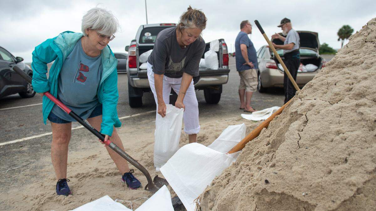
The Mississippi Coast is mostly outside the Francine’s probable track. But the coastal counties and Pearl River County are under a tropical storm warning. The Coast is also on the dangerous “dirty-side” of the storm, which could bring winds, flash flooding and 3 to 5 feet of storm surge.

Flash flooding likely in MS
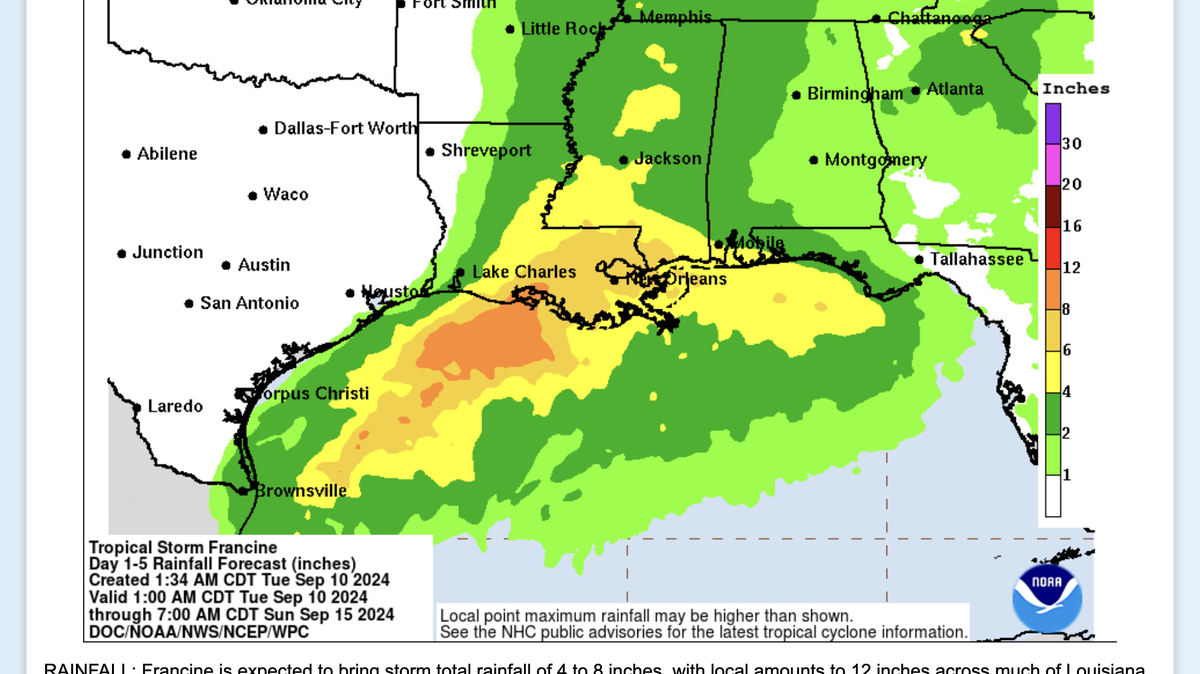
Mississippi is most at risk for heavy rain and flash floods, the National Weather Service said. The threat will come Wednesday afternoon through Thursday morning.
The National Weather Service said flooding is likely.
Southwest and central Mississippi, including Natchez, Hattiesburg, Jackson and parts of the Delta could face 4 to 6 inches of rain, forecasters said. Forecasts say the rain will lead to flash flooding that could close roads and gush over the banks of some rivers.

The Meridian area faces a lesser threat: Forecasts call for 2 to 4 inches of rain, with localized flash flooding in low-lying and urban areas.
Flood threats could move north on Thursday, depending on Francine’s track after it makes landfall.
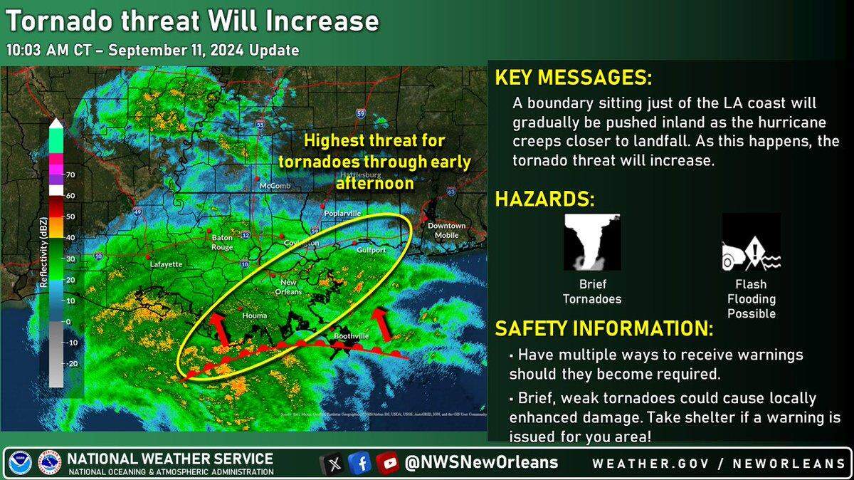
Francine could create tornadoes
Severe storms that hit late Wednesday afternoon and night could unleash tornadoes and dangerous wind gusts, the National Weather Service said. Natchez, Jackson, Hattiesburg and Laurel face marginal risk of severe storms.
By Thursday, forecasters say the severe storm risk will shift to Meridian, Philadelphia and Columbus.
Isolated severe storms in each region could last through Thursday afternoon.
The threat of tornadoes is highest Wednesday afternoon through Thursday afternoon, forecasters said.

Southwest Mississippi faces wind risk
Strong, gusty winds will down trees and power lines Wednesday afternoon and Thursday throughout Mississippi, forecasters said. Some power outages are expected.
The southwest corner of Mississippi has a 30 to 80 percent chance of tropical storm force winds. The earliest winds could arrive Wednesday morning. Forecasters say the strongest winds will blow Wednesday night and Thursday morning.

Parts of Wilkinson, Amite, Adams and Franklin counties could face elevated wind threat: Forecasters are warning of 45 to 55 mile per hour gusts. The wind could lead to widespread downed trees and power lines, roof damage and blocked roads. Forecasters also said power outages could last several days.
The rest of southwest Mississippi, the Jackson metro and the lower Delta are at limited risk of wind: Forecasters expect gusts of 30 to 45 miles per hour. The wind could down some trees and power lines, block roads and lead to power outages that last one to two days, forecasters said.
This is a developing story. Check back for updates.
This story was originally published September 10, 2024 at 9:18 AM.