Tropical Storm Francine’s track shifts closer to South Mississippi. See latest forecast
READ MORE
Hurricane Francine
Francine is expected to make landfall Wednesday as a Category 1 hurricane. While the storm appears headed to the Louisiana coast, Southern and coastal Mississippi could see a risk of flash flooding, according to the National Weather Service.
Expand All
NOTE: This story has been made available for free, for all readers. Please consider supporting local journalism through the purchase of a digital subscription.
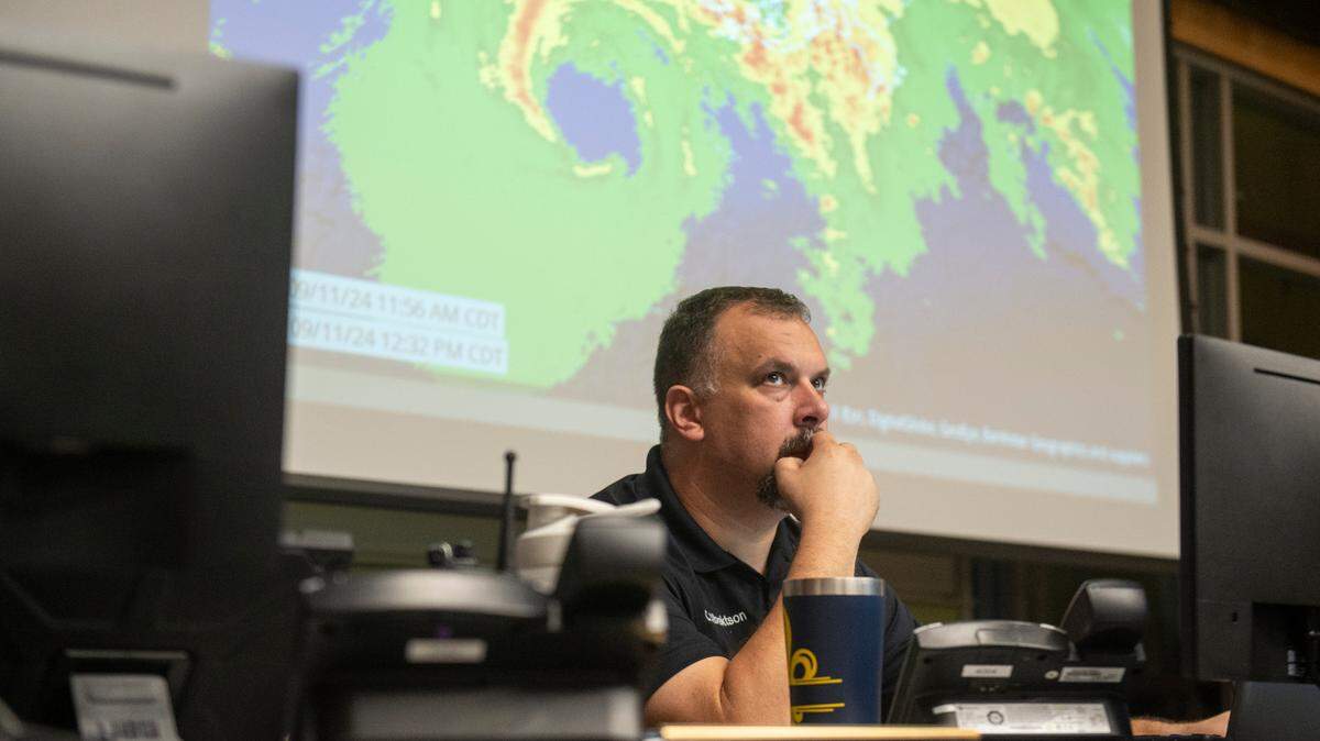
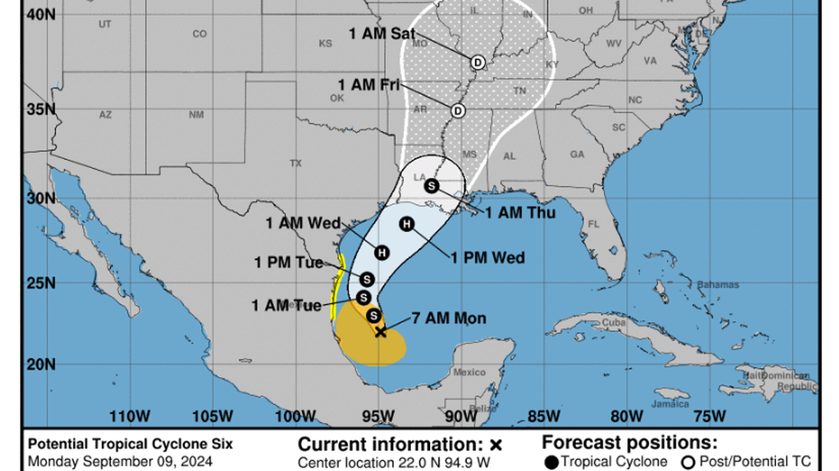
Editor’s note: This report is from Tuesday’s 10 a.m. National Hurricane Center report. For the latest updates, click here.
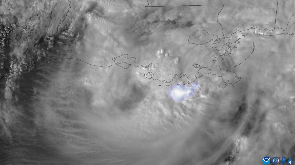
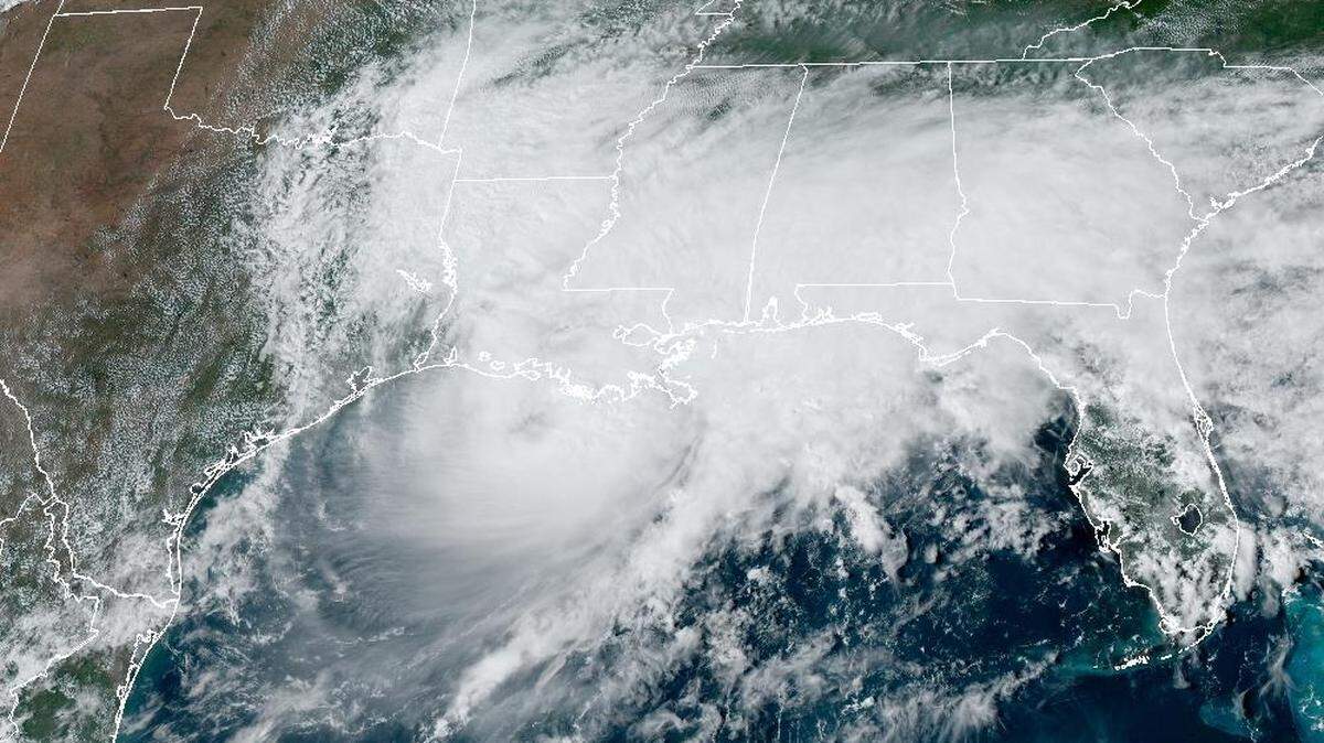
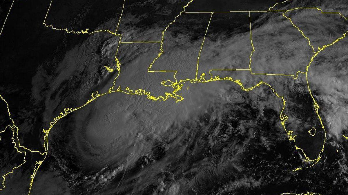
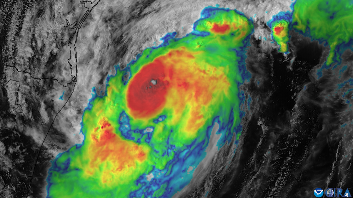
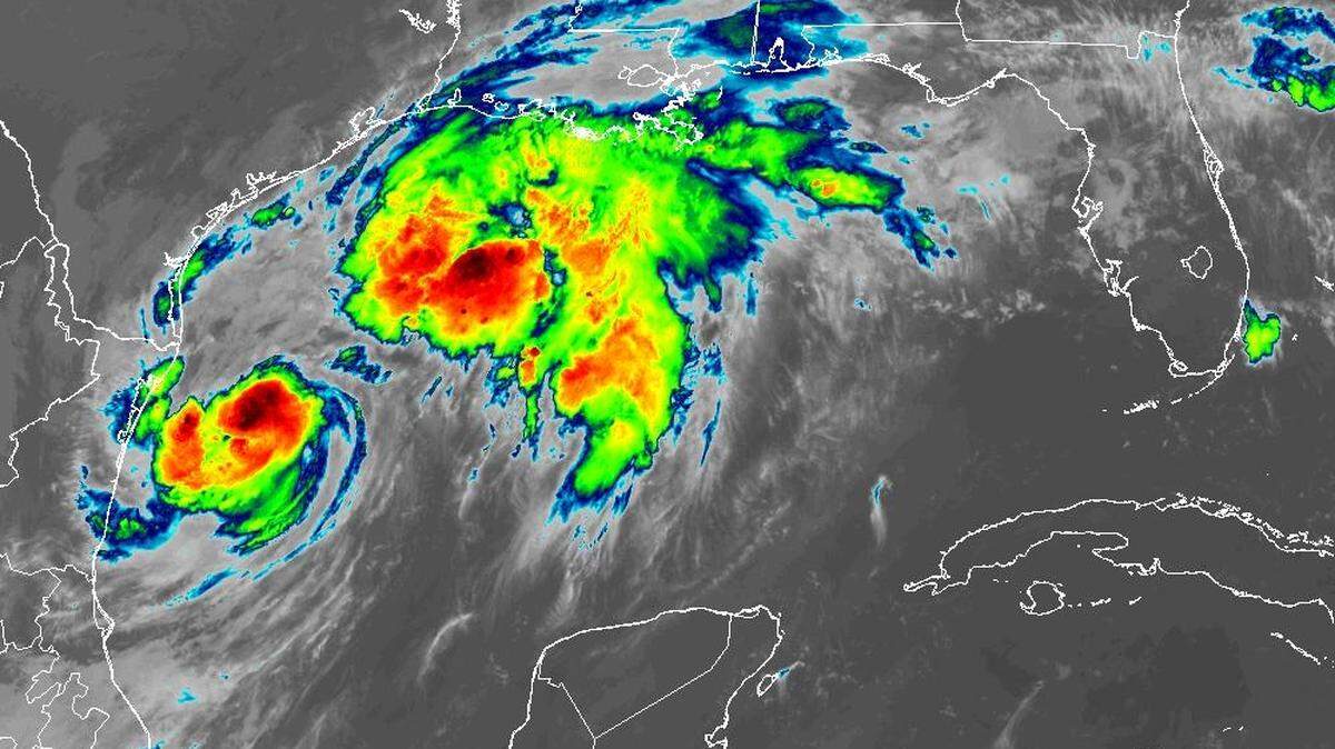
Tropical Storm Francine churned toward Louisiana on Tuesday, where forecasters say it will bring heavy rain, strong winds and storm surge threats that extend from Texas to Mississippi.
The storm shifted slightly east Tuesday morning, forecasters said. It continued to track slowly northwest and is expected to curve northeast Tuesday night and surge toward the Louisiana coast Wednesday afternoon or evening.
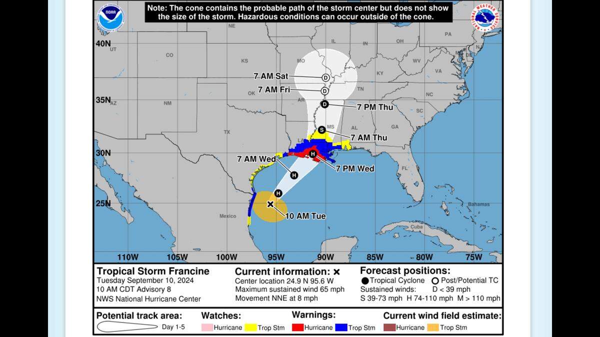
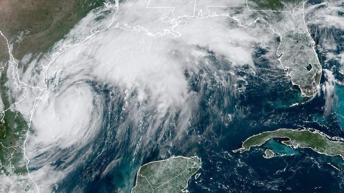
Forecasters say Francine will make landfall in central Louisiana, likely as a Category 2 hurricane. The storm is expected to become a hurricane on Tuesday as it strengthens over warm water in the Gulf of Mexico. But it could avoid rapidly intensifying near the Louisiana coast on Wednesday because of strong wind shear from the southwest.

Francine was 425 miles southwest of Morgan City, Louisiana, on Tuesday morning. It is moving north at 8 miles per hour, with maximum sustained winds of 65 miles per hour, the National Hurricane Center said.
The agency issued a storm surge warning from Texas to the Mississippi-Alabama border, which means rising water could move inland in the next 36 hours. Hancock, Harrison, Jackson and Pearl River counties are under a tropical storm warning. Stone and George counties are under a tropical storm watch.
Surge, wind expected on MS Coast
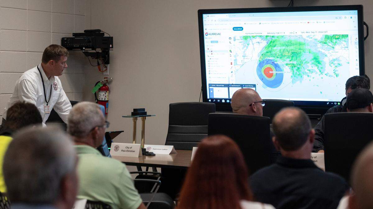
South Mississippi is mostly outside the National Hurricane Center’s “cone of uncertainty,” which represents the storm’s likely track. But forecasters say dangerous conditions can happen outside the cone.
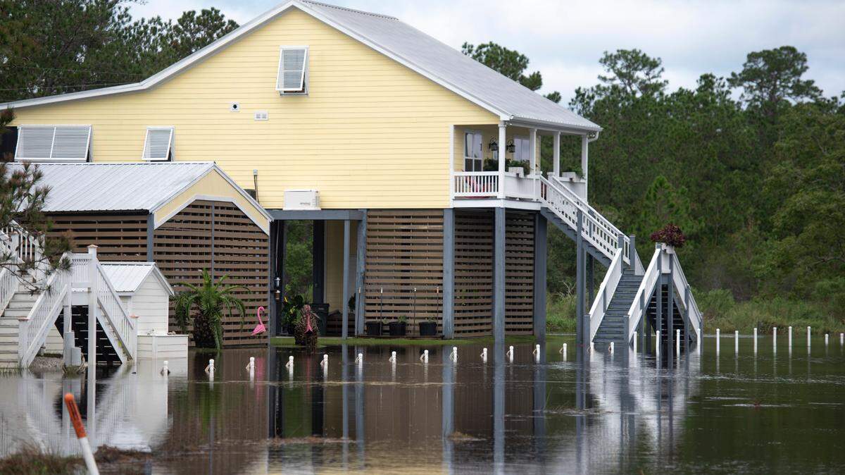
Storm surge predictions increased Tuesday morning: Forecasts now say Francine could bring 3 to 5 feet of storm surge on the Mississippi Coast. The risk lessens further east, but Alabama could also face 2 to 4 feet of water forecasters said.

Hancock and Harrison counties have a 30 to 70 percent chance of tropical storm-force winds on Wednesday. Risk is greatest in Hancock County and lessens farther east. High gusts are also expected in southwest Mississippi, where Francine is forecast to track after landfall.
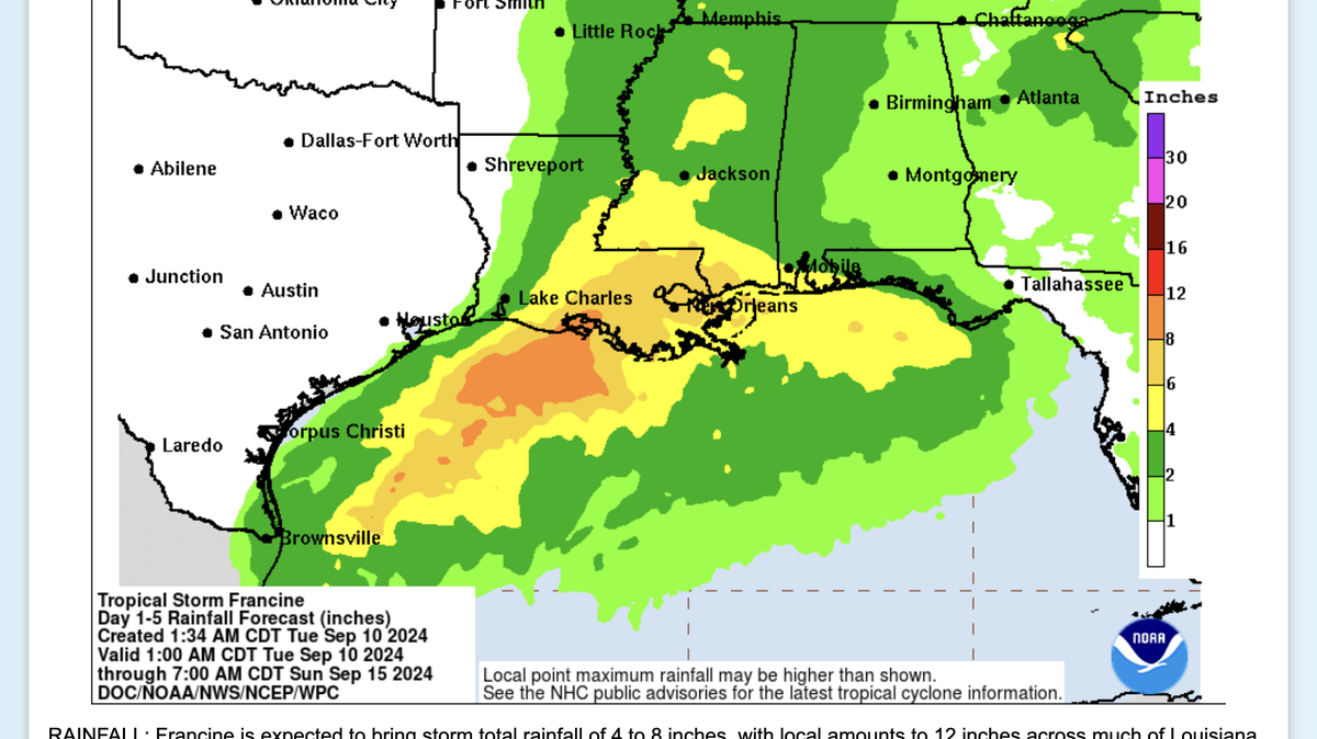
Rain fell steadily on the Mississippi Coast Tuesday morning. But that was only the beginning: Forecasts call for 4 to 8 inches of rain across Louisiana and Mississippi through Friday. Some areas could see as much as 12 inches, forecasters said.
Rainfall chances have increased on the Coast, and Hancock County and western Harrison County could see 6 to 8 inches of rain through this week. The rest of the Mississippi Coast could get 4 to 6 inches through Sunday. Most of the region is under a moderate risk of flash flooding.
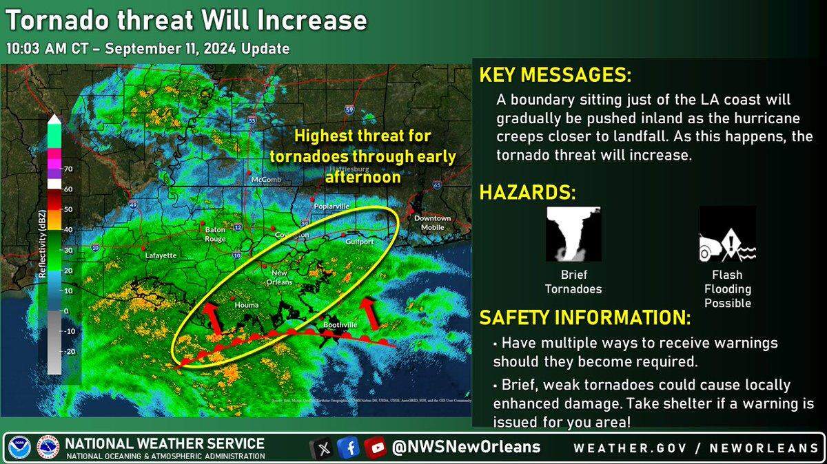
Forecasters also warned Francine could spawn tornadoes on Wednesday across Mississippi, and also near coastlines in Louisiana, Alabama and Florida.

When will impacts start?
Local impacts will start Tuesday night, the National Weather Service in New Orleans said.
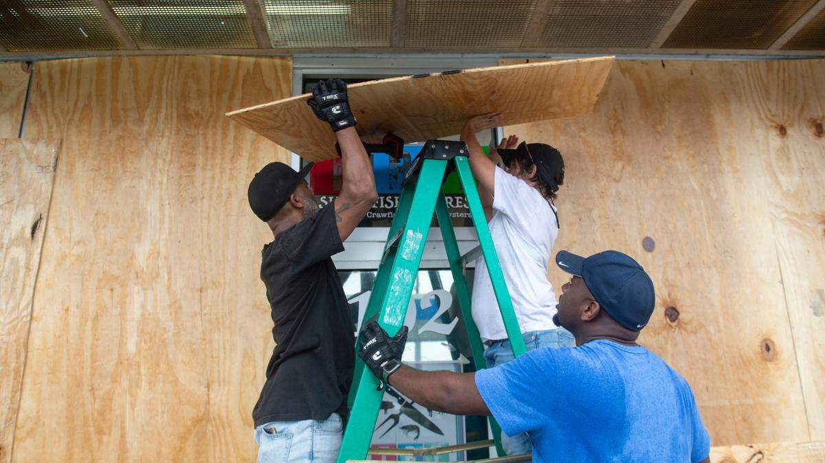
Forecasters said rain, wind and storm surge will worsen through Wednesday. Wind gusts could reach the Mississippi Coast after 2 a.m. Wednesday, according to the National Hurricane Center. Forecasters warned residents to finish preparations Tuesday night.
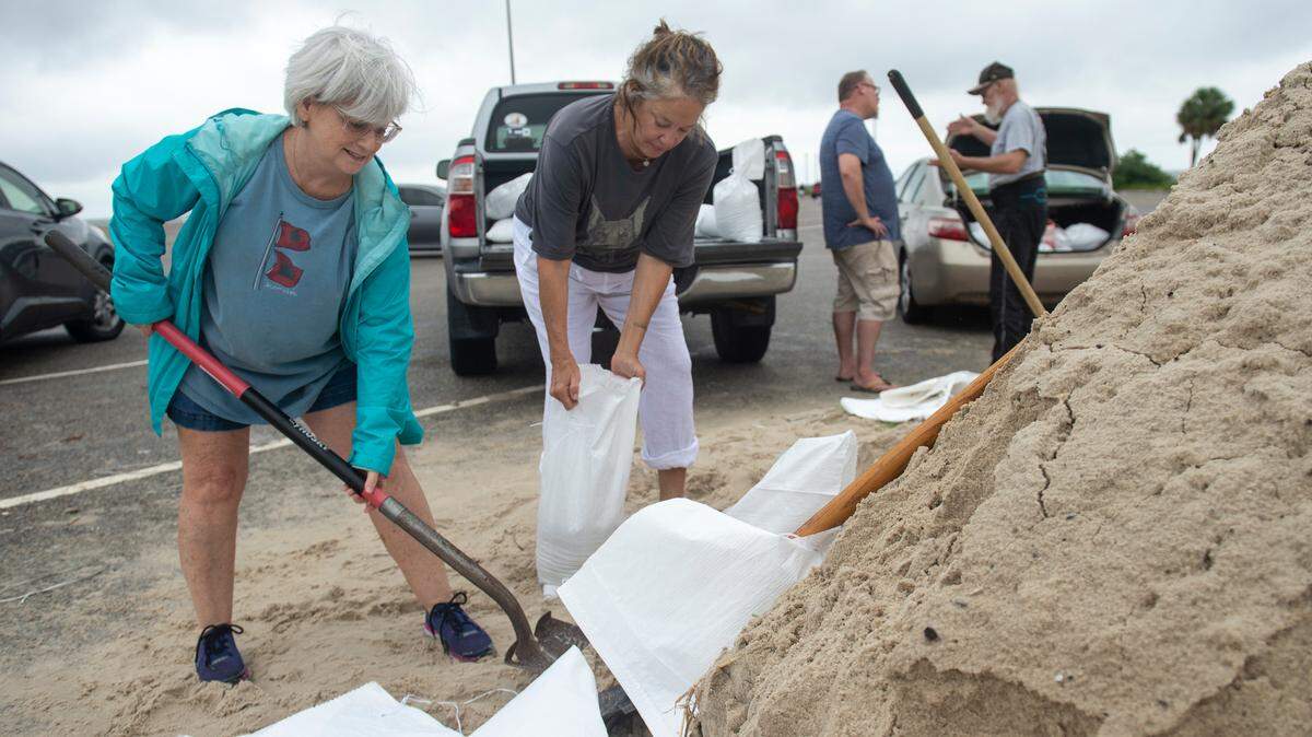
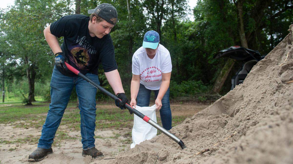
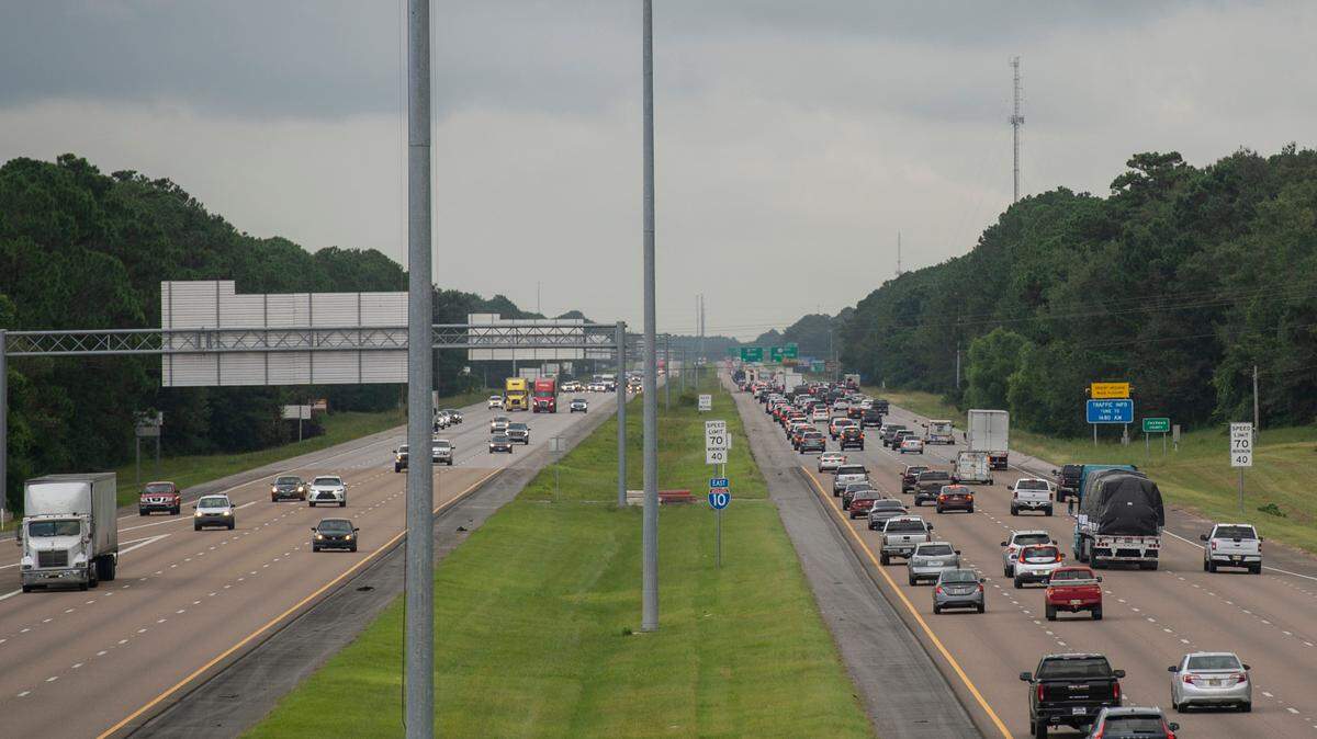
Several schools on the Mississippi Coast canceled Wednesday classes. Residents were also rushing on Tuesday to fill gas tanks, sandbags and evacuate marinas in Biloxi, Pass Christian and Bay St. Louis.

This is a developing story. Check back for updates.
This story was originally published September 10, 2024 at 7:26 AM.