Hurricane Francine downgraded to tropical storm, warnings remain in South MS
READ MORE
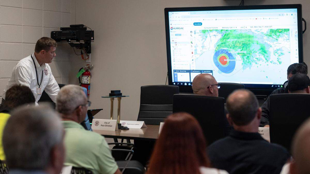
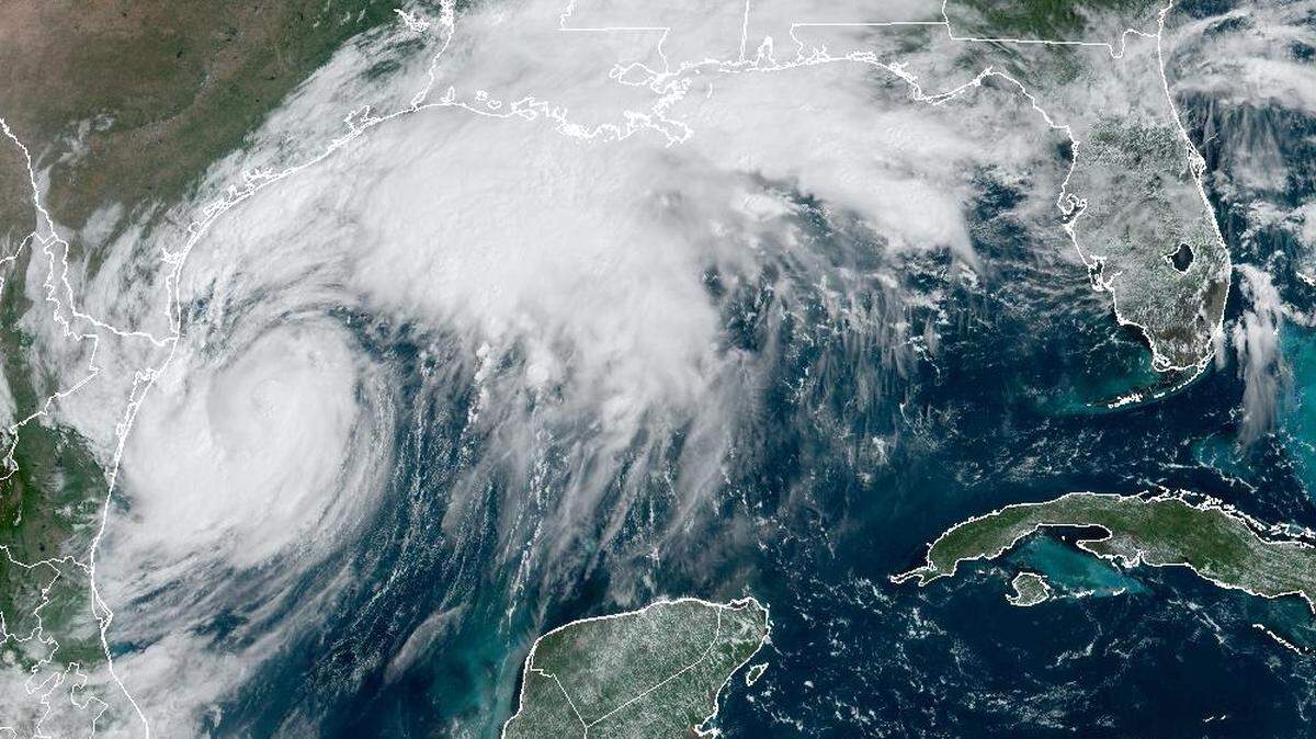
Hurricane Francine
Francine is expected to make landfall Wednesday as a Category 1 hurricane. While the storm appears headed to the Louisiana coast, Southern and coastal Mississippi could see a risk of flash flooding, according to the National Weather Service.
Expand All
NOTE: This story has been made available for free, for all readers. Please consider supporting local journalism through the purchase of a digital subscription.
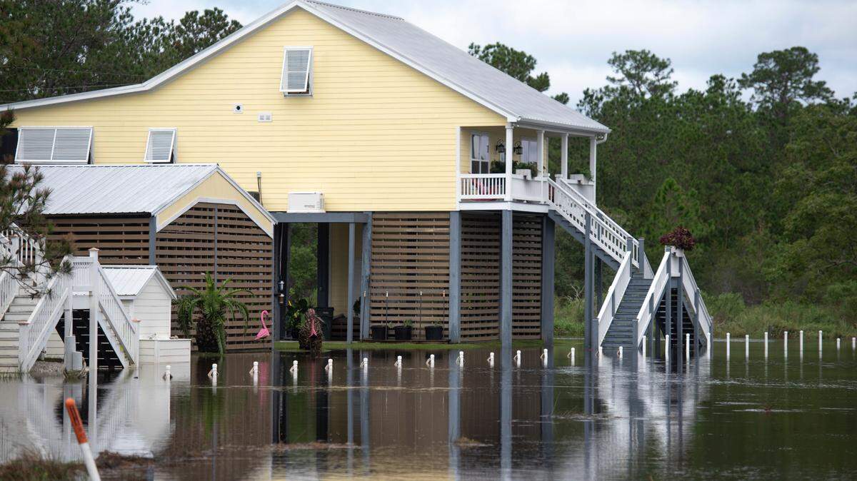
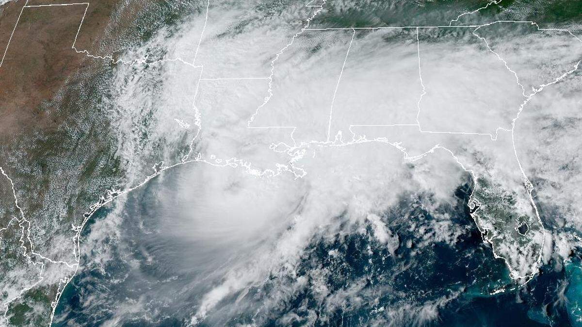
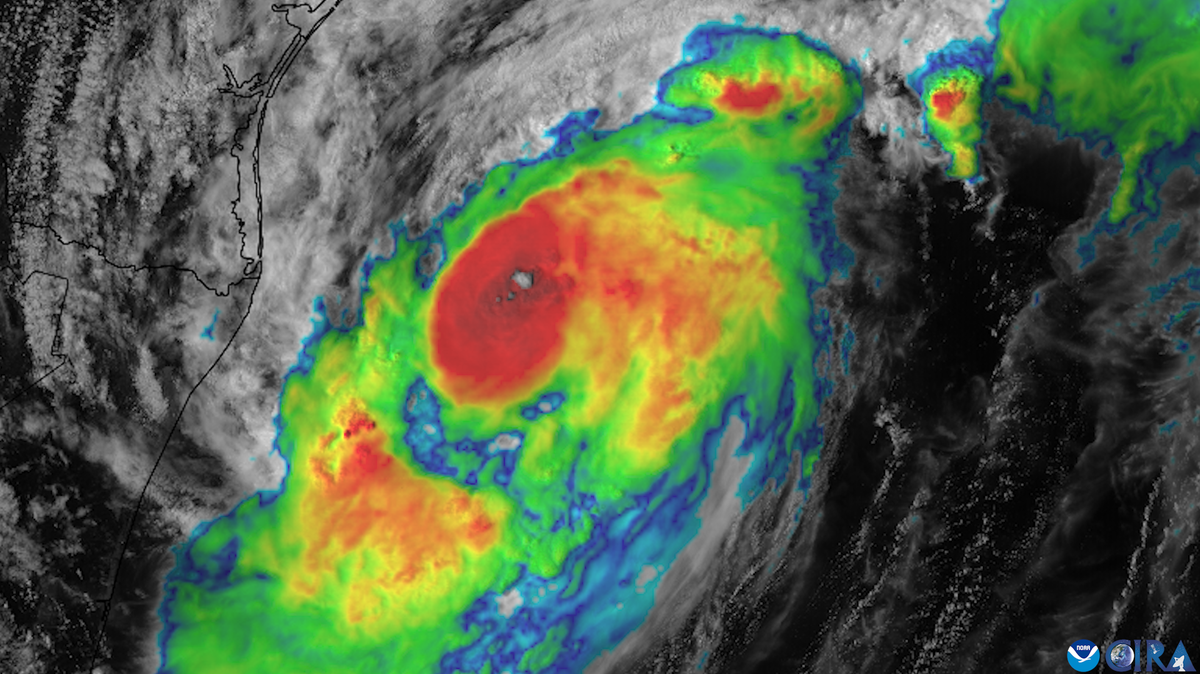
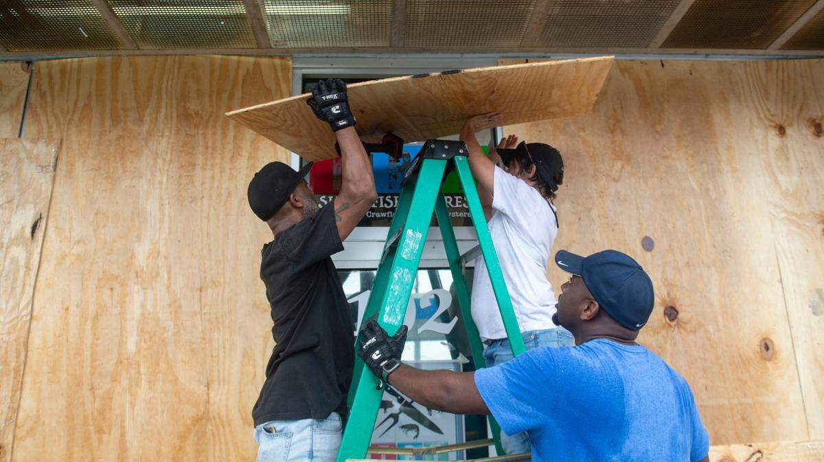
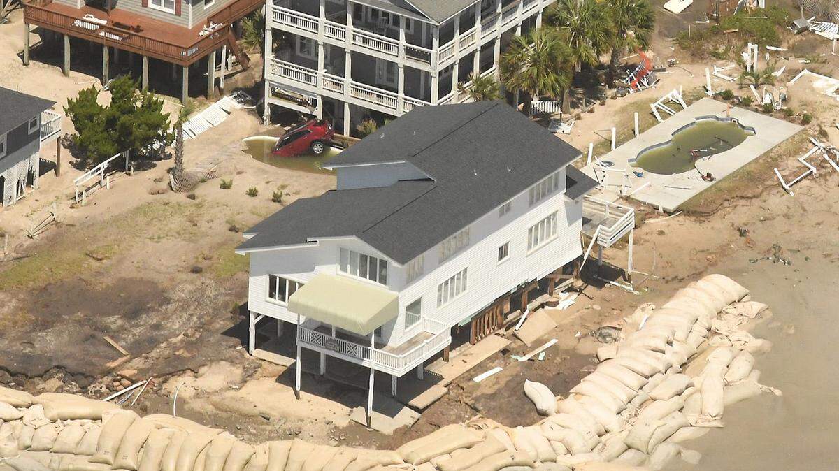
Hurricane Francine pounded toward Louisiana on Wednesday with swirling winds and driving rain that forecasters say will drown streets, spawn tornadoes and flood some parts of the Mississippi Coast with several feet of storm surge before the system barrels north.
The storm made landfall near Morgan City, Louisiana Wednesday afternoon. Forecasters have said storm surge could gush 4 to 6 feet of water in Hancock and Harrison counties, and 3 to 5 feet in Jackson County. Parts of the Louisiana coast are bracing for up to 10 feet of surge. Flash flooding and some tornadoes are also expected across the region.
11:50 p.m.: South MS tornado watch continues
A tornado watch continues until 6 a.m. Thursday for Hancock, Harrison, Jackson, Stone, Pearl River, George, Greene, Forrest, Lamar and Perry counties, the National Weather Service says.
10:50 p.m.: Flash-flood warning in Harrison cities
A flash-flood warning has been issued for southern Harrison and southwestern Jackson counties. The National Weather Service says locations that will experience flash flooding include Gulfport, Biloxi, Long Beach, St. Martin, D`iberville, Latimer and Gulfport Airport.
The weather service has received reports of 3-5 inches of rain in Gulfport and says, “Flash flooding is already occurring..” The warned areas could have another 1-2 inches of rain.
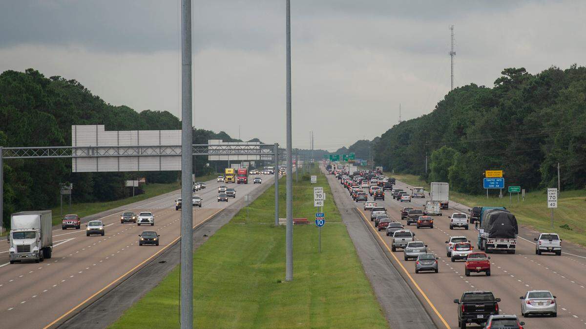
The following interstate stretches are included in the warned areas: I-10 between mile markers 30 and 48, and I-110 near mile marker 1, and between mile markers 3 and 4.
9:51 p.m.: Francine downgraded to tropical storm
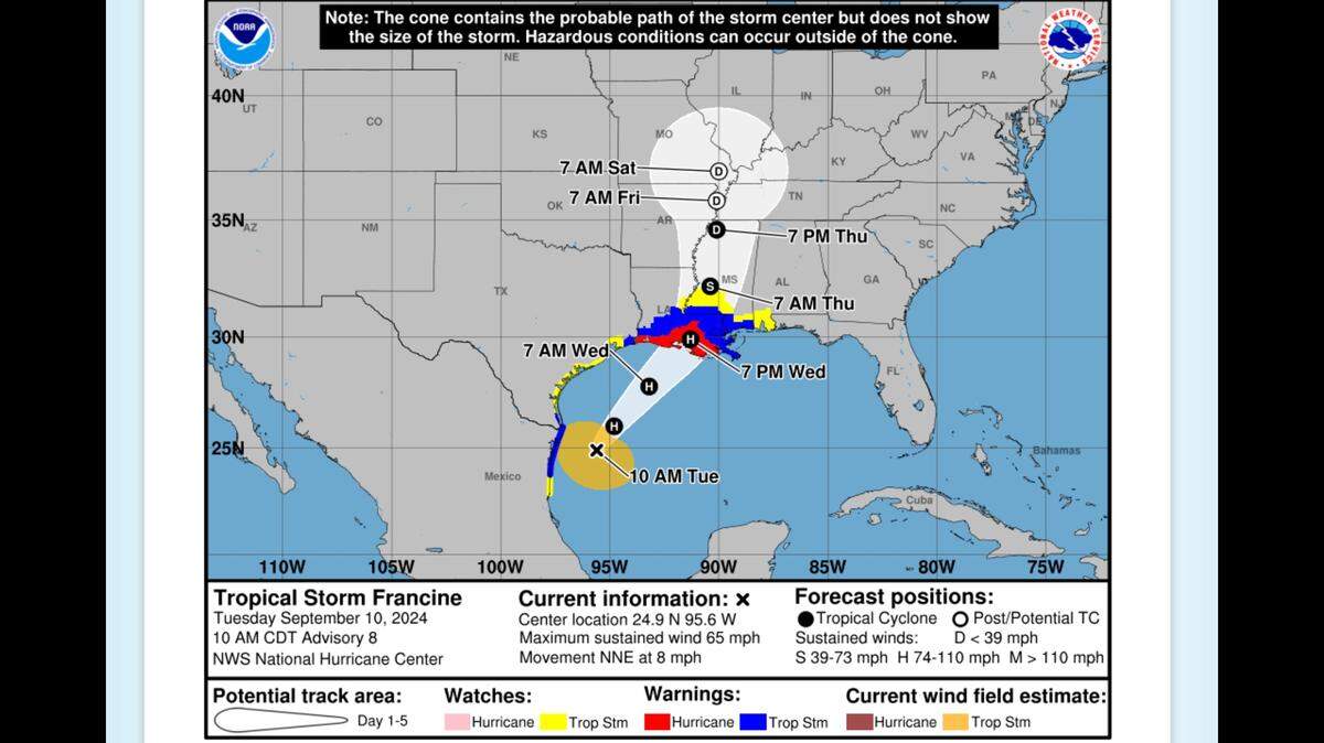
Francine has been downgraded to tropical storm status, with winds at 70 mph, the National Hurricane Center says. Some watches and warnings have been discontinued, but a storm surge warning remains in effect for Mississippi’s three coastal counties and a portion of the Louisiana coastline.
A Tropical Storm Warning is in effect from Intracoastal City, Louisiana, to the Alabama/Florida border. Francine was moving northeast in Louisiana at near 16 mph. The storm was expected to move into the Jackson area Thursday.
8:50 p.m.: Flash flood warning in effect
A flash flood warning is in effect for Southern Hancock County through 11 p.m. Radar indicated thunderstorms producing heavy rain. The National Weather Service says 1-3 inches of rain has fallen. Another 2-4 inches of rainfall is possible.
Bay St. Louis, Waveland, Diamondhead and Pearl River, along with multiple areas in Louisiana, are under the warning. Flooding could happen on small creeks or streams,highways, streets and underpasses, along with low-lying and poorly draining areas.
8:10 p.m.: Potential tornado spotted
A severe thunderstorm capable of producing a tornado was located near Shoreline Park, close to Waveland and moving northwest at 35 mph.
The National Weather Service says radar indicated rotation. The rotation could cause flying debris and damage or destroy mobile homes, roofs windows and vehicles.
8 p.m.: Power outages reported
The three power companies serving customers in South Mississippi are reporting power outages:
▪ Coast Electric reports 433 power outages in Pearl River County, 158 in Harrison County and 17 in Hancock County.
▪ Mississippi Power reports 3 customers without power near Gulfport
▪ Singing River Electric reported 99 customers without power earlier. As of 8 p.m. there was just one without power in extreme eastern Mississippi and 25 in the Hattiesburg area.
7:48 p.m.: Potential waterspout in Hancock
The National Weather Service has issued a tornado warning for southern Hancock County until 8:15 p.m. because a thunderstorm capable of producing a waterspout was located just offshore near Waveland. The thunderstorm was moving northwest at 35 mph.
7:14 p.m.: Tornado time is arriving
Now is the time to remain alert for tornadoes from Hurricane Francine, especially because South Mississippi is on the “dirty side” of Hurricane Francine.
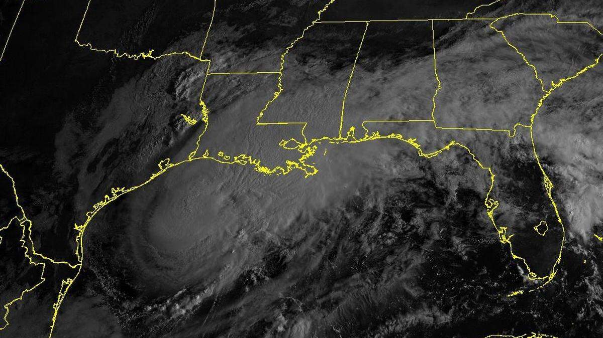
Francine’s eye is just west of New Orleans, moving northeast toward the North Shore in Louisiana. National Weather Service meteorologist said Shawn O’Neil thunderstorm cells are spinning ahead and east of the eye, so the biggest danger of tornadoes for Hancock County is now.
“This is the prime time to watch for those,” he said. Also, the outer edges of the eyewall brush by Hancock County, intensifying the major storm-surge and tropical-storm-force winds already expected..
While the hurricane’s outer bands have arrived in South Mississippi, the eye is over Houma now. Francine should remain to South Mississippi’s left, O’Neil said, passing in the next two to four hours and reaching Jackson tomorrow.
5:10 p.m.: Landfall
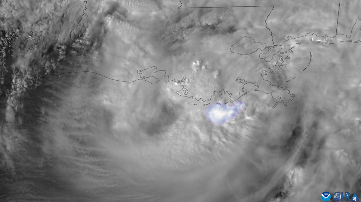
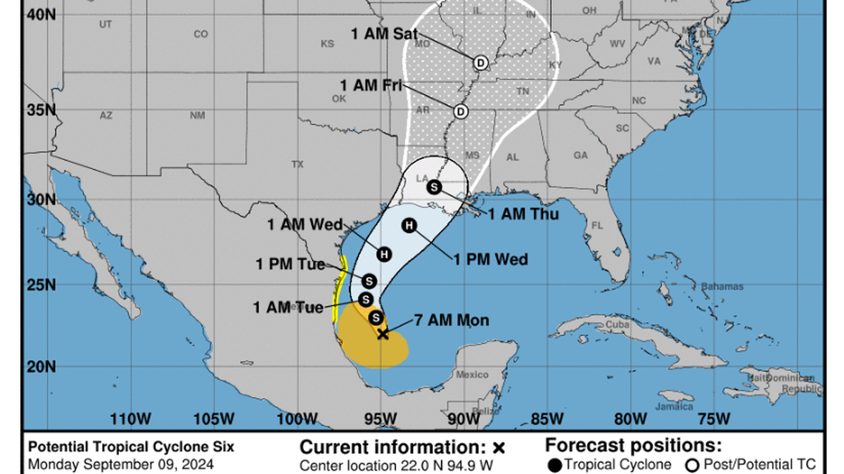
According to the National Weather Service, Hurricane Francine has made landfall in southern Louisiana in the Parish of Terrebonne, about 30 miles south-southwest of Morgan City, as a Category 2 hurricane. Maximum sustained winds are estimated to be near 100 mph.
4 p.m.: It’s a Category 2 storm
Hurricane Francine strengthened into a Category 2 storm and is expected to soon make landfall in Louisiana, with forecasters warning of potentially deadly storm surge, widespread flooding and destructive winds on the northern U.S. Gulf coast.
Francine is being powered by warm Gulf of Mexico waters. The storm is forecast to crash into a fragile coastal region that still hasn’t fully recovered from a series of devastating storms in 2020 and 2021.
4 p.m.: Harrison County responders prepared
Harrison County road crews are prepared to be out early Thursday, clearing down trees and other debris from roadways. In the last emergency operations meeting before the storm, first responders and community leaders also learned the state has no plans to close U.S. 90 unless the beach highway becomes impassable.
Harrison County GIS Director Dusty Reed said rivers will begin flooding Wednesday night, starting with the Biloxi River, followed by the Tchoutacabouffa on Thursday morning and the Biloxi River on Friday.
4 p.m.: More Walmart stores close
Three Walmart stores in South Mississippi are closed ahead of Francine, in addition to three that closed earlier. The Gulfport Walmart on U.S. 49 is closed, along with the Neighborhood Market stores at Orange Grove and on Pass Road.
Earlier Wednesday afternoon the Walmart stores at Waveland, Picayune and Pass Christian closed.
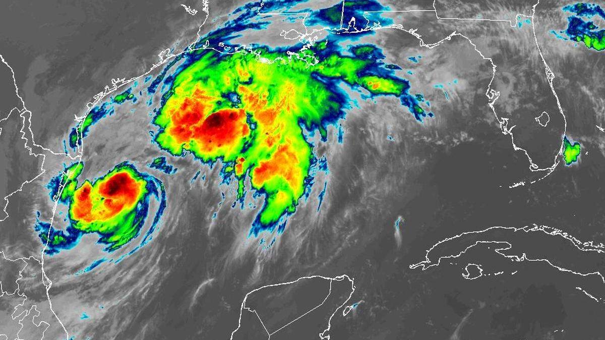
3 p.m.: Eyewall nears Louisiana
Francine’s eyewall spun closer to Louisiana Wednesday afternoon. Hurricane-force winds in the northern eyewall are nearing the coastline, the National Hurricane Center said in a 3 p.m. update.
The storm is still 60 miles south of Morgan City, Louisiana.

2:53 p.m.: A Louisiana Waffle House is closing?!?
According to nola.com, reporters found the staff of the Waffle House in LaPlace, east-northeast of New Orleans, flipping chairs onto tables and preparing to close Wednesday morning ahead of Hurricane Francine.
While finishing a meal, a waitress told guests that the restaurant, known for staying open through hurricanes, would close before Francine made landfall on Wednesday evening. Diners were asked to leave before noon.
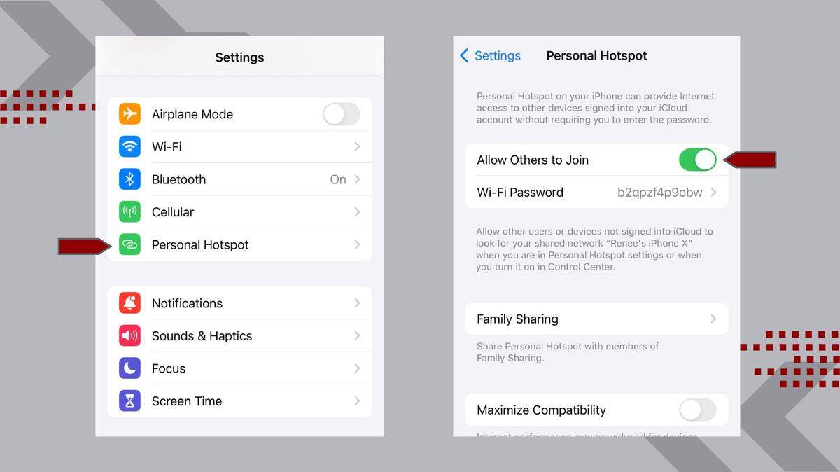
2:25 p.m.: How to stay online
Hurricanes and our power grid tend not to get along. So what happens if you lose power, but need to stay online? Major wireless carriers customers can still find service even when the internet is out at home. Here’s how.
2:20 p.m.: Offshore gust of 112 mph
The National Hurricane Center said hurricane-force winds were just offshore of Louisiana at 2 p.m. An oil platform An oil platform southeast of Francine’s center reported sustained winds of 92 miles per hour, with a gust 112 miles per hour.
2:15 p.m.: More schools cancel Thursday classes
Districts and schools across the Coast are continuing to cancel Thursday classes. For our complete list of districts and schools and the announcements they have made so far, click here.
1:51 p.m.: The Weather Channel in Gulfport
Meteorologist Molly McGrath is one of six reporters The Weather Channel has in the field reporting on Hurricane Francine from Gulfport. McGrath, who is in Gulfport, is the only one in Mississippi.
1:28 p.m.: More curfews issued
Two cities in Hancock County have curfews in place ahead of Hurricane Francine.
Bay St. Louis Mayor Michael Favre says a curfew will be enforced from 10 p.m. Wednesday until 5 a.m. Thursday.
“Waveland has the same thing,” he said, following the same hours.
Gulfport’s curfew runs from 6 p.m. Wednesday through 6 a.m. Thursday.
1 p.m.: Francine closes in
Hurricane Francine’s forecast changed little in the National Hurricane Center’s 1 p.m. update. The storm is still a Category 1 hurricane expected to make landfall late Wednesday afternoon or evening.
Francine was 95 miles south of Morgan City, Louisiana and moving northeast at 16 miles per hour. Tropical storm conditions reached the Louisiana coast by 1 p.m., forecasters said.

12:55 p.m.: Watch for critters
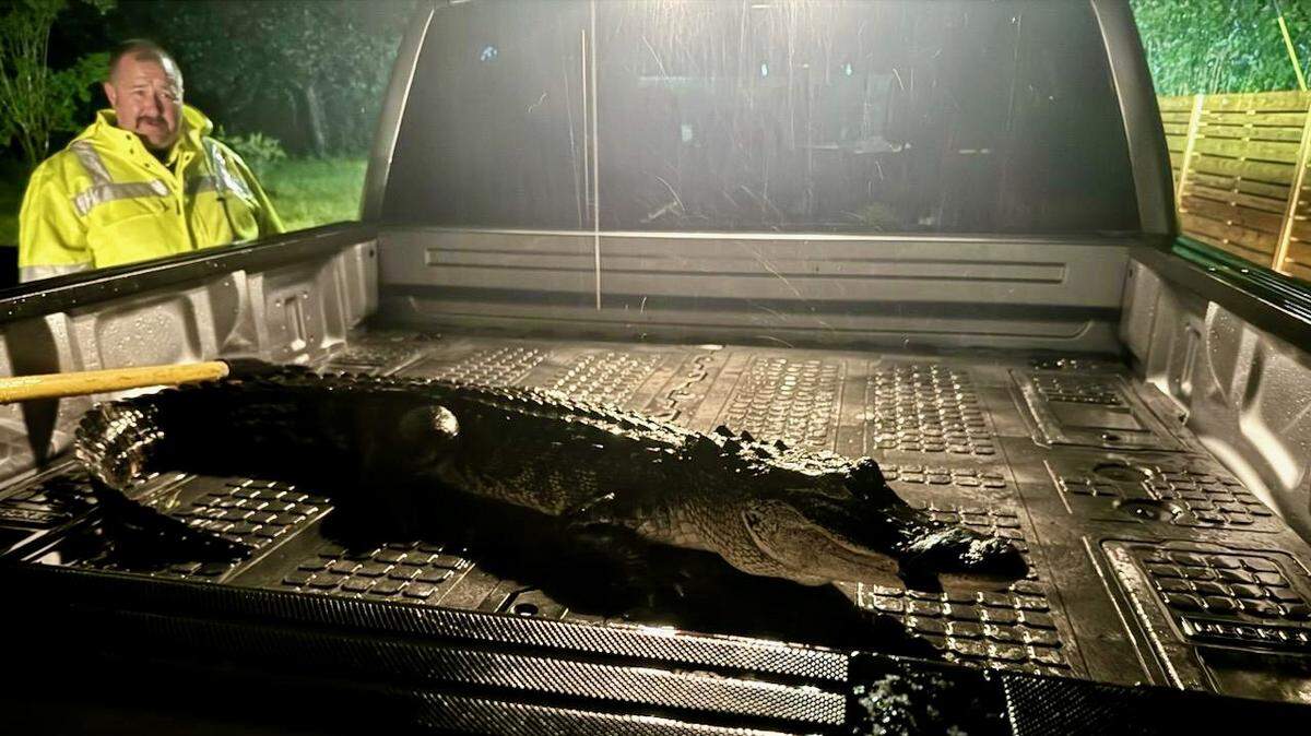
Tropical Storm Francine may send more than rain and gusts of wind your way. Storm conditions will have rodents running for shelter and insects breeding in the downed trees and standing water Francine leaves behind.
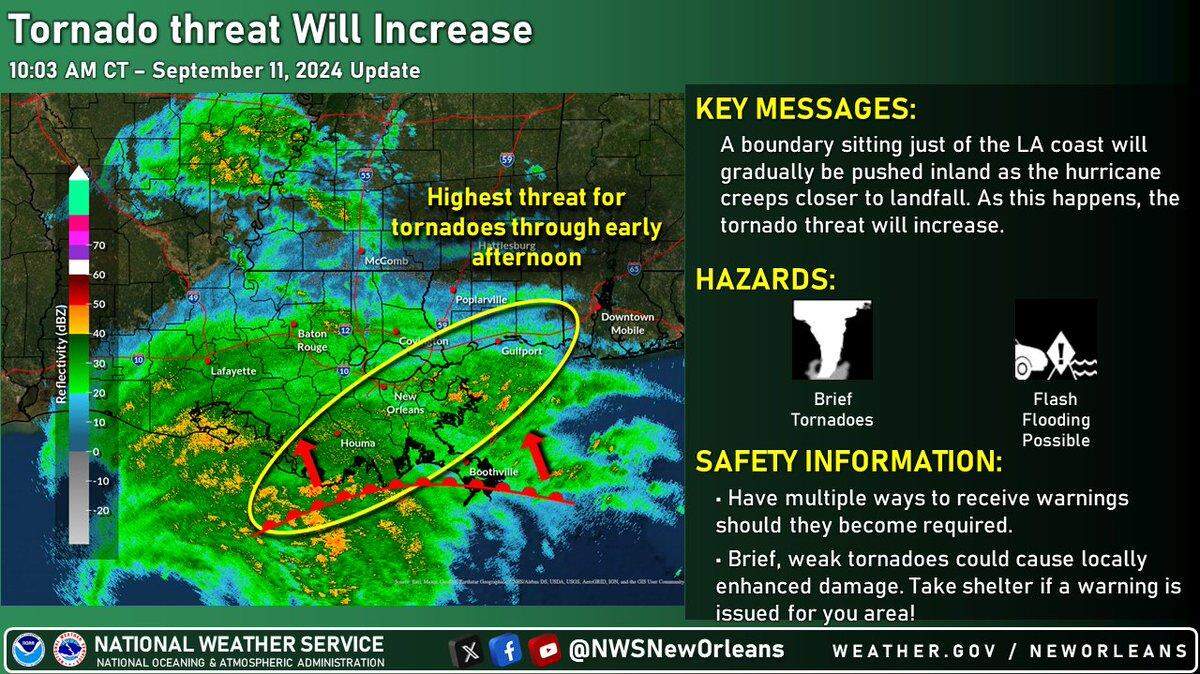
12:50: Tornado watch issued
Hancock, Harrison and Jackson counties are under a tornado watch. Read more about Hurricane Francine’s tornado threat here.
12:40 p.m. Curfew issued in Gulfport
Gulfport Mayor Billy Hewes issued a curfew starting at 6 p.m. Wednesday through 6 a.m. Thursday. No one will be allowed on public streets or property except for emergency personnel.
“These actions are being taken to ensure public safety as Hurricane Francine approaches, bringing high winds, potential flooding, and other hazardous conditions,” Hewes posted on Facebook.

12:20: Harrison County shelter filling
Red Cross volunteers are running the County Farm Shelter in Harrison County and Harrison County Sheriffs deputies are on hand for added security. The shelter opened at 7 am and so far 3 bus loads of evacuees have landed here. Though this shelter allows animals, none are here as of noon, but 45 evacuees are set up on cots inside.
12:10 p.m.: Francine nears landfall
Francine’s rain bands are moving inland in Louisiana, and tropical storm-force winds are just offshore, the National Hurricane Center said in a noon update.
“Conditions will continue to deteriorate throughout the afternoon,” the update said. “Ensure you are in a safe location before the onset of these strong winds or possible flooding, and have multiple ways to receive warnings.”

11:45 a.m.: Don’t wait too long to shop
Rouses Market announced that stores at Ocean Springs, Diamondhead and Gulfport will close at 6 p.m. Wednesday.
Walmart at Waveland, Pass Christian and Picayune Walmart close at 3 p.m. Wednesday.
Winn-Dixie in Long Beach will close at 7 p.m.
Tatonut Donut Shop in Ocean Springs sold out of donuts before noon Wednesday, as people stocked up on storm treats, and plans are to reopen Friday.
11:30 a.m.: Tornado threats expected
The threat of tornadoes will increase on the Mississippi Coast over the next few hours, the National Weather Service said. The highest risk is early Wednesday afternoon.
11:22 a.m.: Wind gust over 100 mph reported
The National Weather Service reports an offshore oil platform north of Hurricane Francine’s center recently reported sustained winds of 85 mph and a gust of 101 mph at an elevation of 98 feet.
Workers were evacuated from oil platforms in the Gulf before the storm.

11:15 a.m.: Latest on water and gas supplies
Rouses Markets in South Mississippi continues to be open regular hours, while Rouses stores are closing in Louisiana before the storm makes landfalls. There are still a lot of people out picking up last minute supplies, says Sun Herald reporter Margaret Baker. Fuel is still available at most gas stations and Waffle House restaurants remain open, she reports.
11 a.m.: Emergency services on standby
Emergency managers in each coastal county said Wednesday morning that no impacts from Hurricane Francine have hit yet.
A few minor floods were reported on Hancock County roads, and about eight people are in the county’s shelter, Emergency Manager Brian “Hooty” Adam said. He said fire departments in Bay St. Louis and Waveland are on standby, a boat rescue team is in town from north Mississippi and the Sheriff’s Department has boats ready to go.
“If we have to try to get people out, we can,” Adam said. But he said most residents of the county — which has some of the lowest ground on the Coast — are accustomed to floods. “They really know how to handle that situation,” he said.
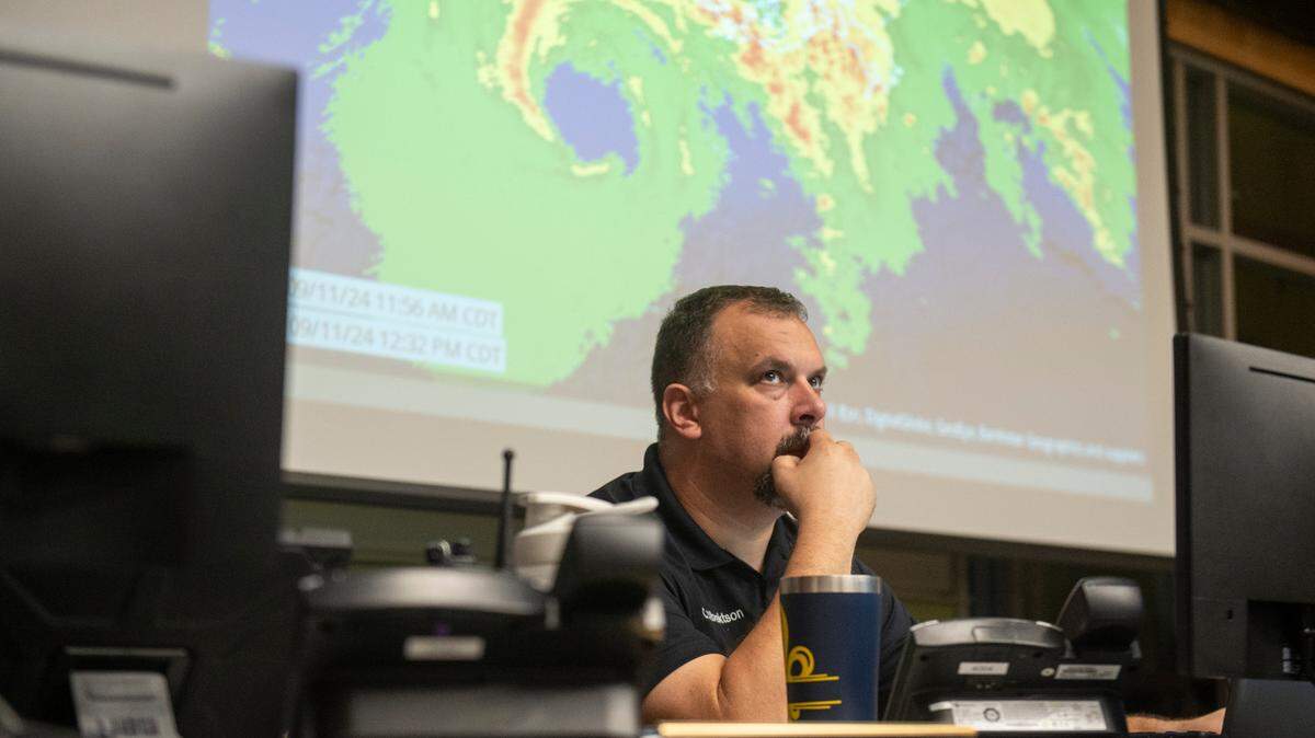
Harrison County expects impacts later Wednesday, Emergency Manager Matt Stratton said. The county’s emergency teams have finished preparations, and road and public safety teams will work through the night. “We are ready to go,” he said.
And in Jackson County, Emergency Manager Earl Etheridge said local officials and the Mississippi Emergency Management Agency are ready to respond.
“It’s cloudy and sprinkling. That’s about it,” he said. “We’re just sitting here waiting and watching.”
10:50 a.m.: High tide brings Coast flooding
South Mississippi will be nearer to low tide when Hurricane Francine is forecast to come ashore in Louisiana Wednesday. The high tide at 4:45 a.m. Wednesday brought water over the road on North Clark street and to the edge of the road on the canal on Davis, the City of Pass Christian reports. Canals elsewhere are a foot or more below their banks. High tide in the city is at 5:50 a.m. Thursday.
10:35 a.m.: Storm chaser checks in from Louisiana
Bay St. Louis resident Josh Morgerman, a popular storm-chaser known online as @icyclone, has camped out in Morgan City, Louisiana .— at least for now.
10 a.m.: No further strengthening?
Hurricane Francine’s intensity and track had not changed by 10 a.m. Wednesday. Increasing wind shear and dry air will likely stop the storm from strengthening more before landfall, the National Hurricane Center said.
Francine is 150 miles southwest of Morgan City, Louisiana at 10 a.m. It is moving northeast at 13 miles per hour with maximum sustained winds of 90 miles per hour, forecasters said.
The National Hurricane Center said tropical storm-force winds could arrive in parts of the Mississippi Coast between 2 and 8 p.m.
9:45 a.m.: Feeder bands coming ashore
The National Weather Service posted on X the radar feed of outer bands reaching Louisiana.
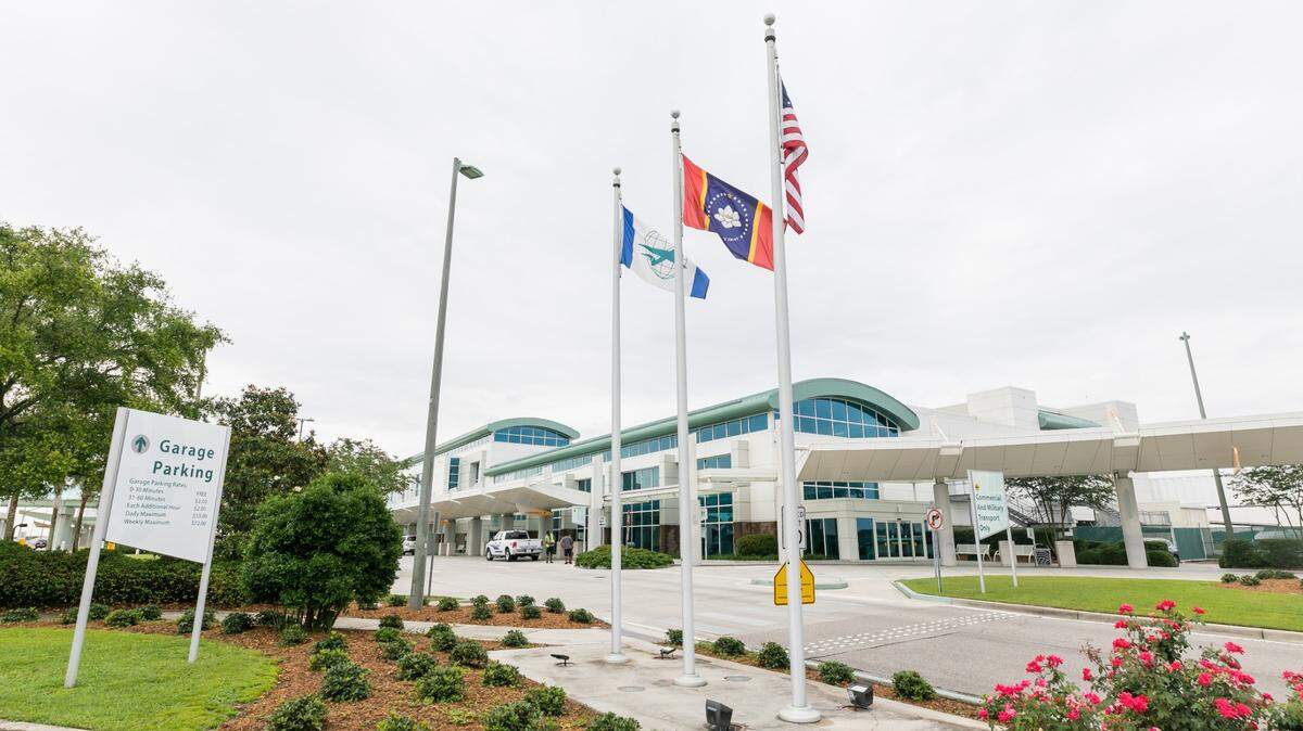
9 a.m.: Flight cancellations at Gulfport-Biloxi
All departures after 2:35 p.m. have been canceled at Gulfport-Biloxi International Airport.
Additionally, a 12:41 American Airlines flight has been canceled, according to the airport’s departures and arrivals tracker. Some flights departing or arriving Wednesday morning appeared on schedule as of 9 a.m.
8:20 a.m.: Prepare for power outages
Power outages are possible across South Mississippi, particularly in Hancock and Pearl River counties, as Hurricane Francine moves north. No widespread outages were reported early Wednesday. Here’s how to check for power outages in your county.
Residents should keep their cell phones charged throughout the day. Since landfall is expected Wednesday night, it’s advised that residents have extra batteries for flashlights.

8 a.m.: Businesses and beaches are closed, buses not running
While Waffle House restaurants are open, the list of businesses closing as Francine approaches continues to grow. Here is the latest.
Harrison County beaches are closed Wednesday.
Coast Transit Authority in Harrison County will stop regularly scheduled Fixed Route and Demand Response (ADA Paratransit or ADA Paratransit Plus) service at noon Wednesday, CTA offices also close at noon.
7:30 a.m.: School closings
Schools across South Mississippi are closed Wednesday, and Harrison County schools will be closed Thursday, with other districts discussing plans.
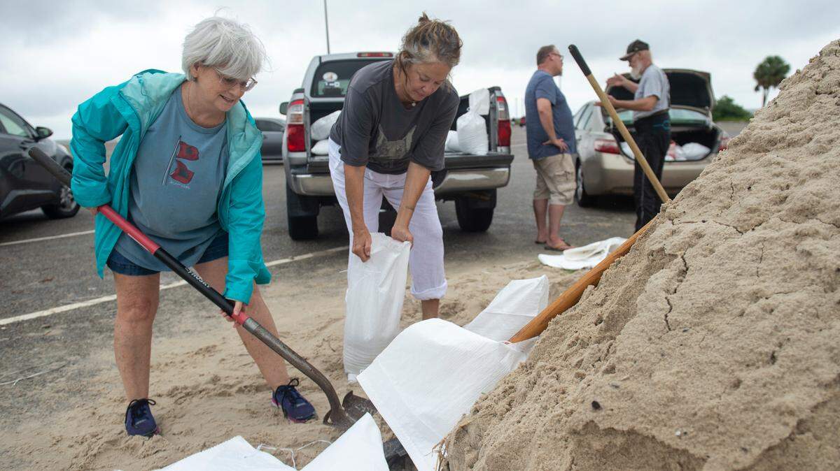
7:25 a.m.: Shelters and sandbags available
Shelters are opening across South Mississippi and sandbag locations are still available. The National Weather Service is warning residents to rush preparations to completion and shelter in place Wednesday afternoon and evening. Here’s the full list of shelters and sandbag locations in South Mississippi.

6:50 a.m.: Hurricane Hunters investigating
Air Force Reserve and NOAA Hurricane Hunters investigating Francine early Wednesday reported maximum sustained winds of 90 miles per hour with stronger gusts, the National Hurricane Center said.
The Air Force Reserve Hurricane Hunters, based at Keesler Air Force Base in Biloxi, moved their home base to San Antonio for the duration of the storm.
Francine was 195 miles southwest of Morgan City around 7 a.m.
6:30 a.m.: Francine strengthens
Francine strengthened overnight and is surging toward Louisiana with a defined eye wall, forecasters said Wednesday morning. The storm could strengthen further as it crosses warm Gulf of Mexico waters on Wednesday, but southwest winds are expected to keep it as a Category 1 at landfall.
Francine had maximum sustained winds of 90 miles per hour and was 245 miles southwest of Morgan City at 4 a.m., forecasters said.
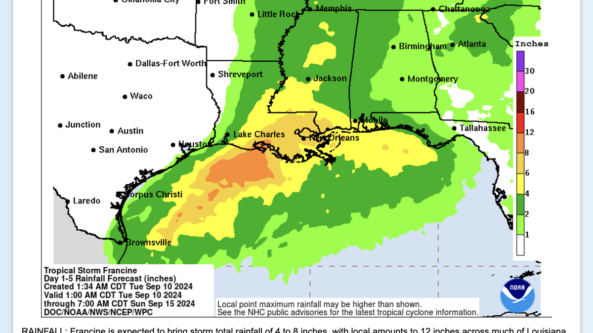
The National Hurricane Center warned of “life-threatening storm surge” on Wednesday for Louisiana and Mississippi’s coasts. Francine is also expected to bring widespread flash flooding.
Forecasters say the storm will quickly weaken over land and become an extratropical cyclone on Thursday over northern Mississippi.

The Sun Herald will update this article throughout the storm. Send tips to MyNews@sunherald.com.
This story was originally published September 11, 2024 at 6:30 AM.