
Flash flooding is possible across South MS this week. How much rain will fall?
Several days of rain will drench South Mississippi this week with downpours that could flood urban areas, forecasters said.
Street flooding is possible across the Mississippi Coast and the risk is highest above Interstate 10 in northern Pearl River and Stone counties. The National Weather Service said Hancock, Harrison and Jackson counties could get up to 6 inches of rain by Friday morning.
“It’s going to be a very rainy week,” said Hannah Lisney, a meteorologist at the National Weather Service in Slidell.
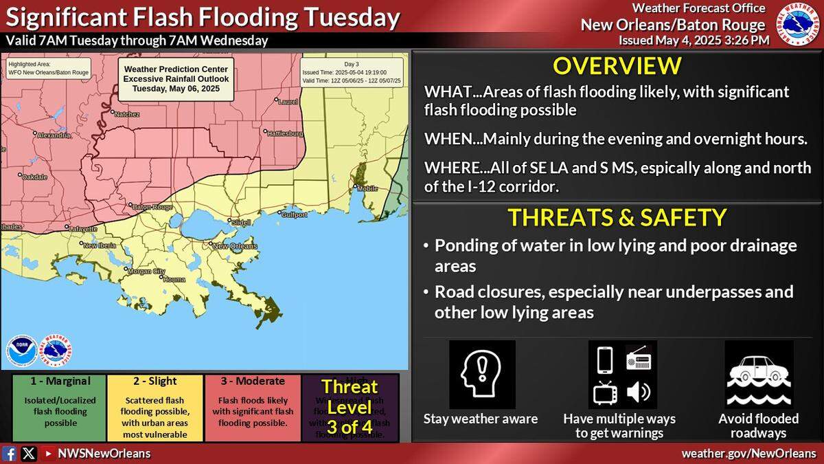
Lisney said the first and heaviest rain system would probably arrive Tuesday evening and last through Wednesday. Up to three inches of rain could fall before Thursday morning.
The rain could slack off on Wednesday before downpours start again on Thursday, according to the National Weather Service.
The Mississippi Coast is under a slight risk of flash flooding, which means scattered floods are possible in urban areas where rainwater has fewer places to drain.
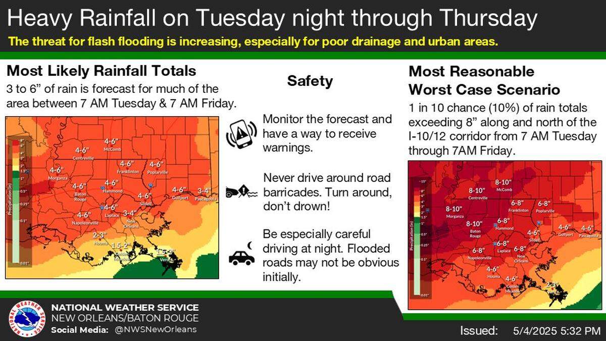
The chance of rain will not let up all week. Slightly less rain is forecast in eastern Jackson County, but rain chances on Thursday in Gulfport are 90 percent. Forecasts show showers and a thunderstorm are also possible Friday afternoon.
Forecasters say so far, there is little threat of storms or severe weather. But Lisney said the rain could lead to minor flooding on some rivers.
The National Weather Service warned drivers to be cautious, especially at night when flooded roads may not be obvious.
This story was originally published May 5, 2025 at 11:11 AM.