Where will Sally make landfall? Cat 2 hurricane stumps experts as it meanders in Gulf
Editor’s note: Find the latest Tuesday updates here.
Hurricane Sally is confounding weather experts.
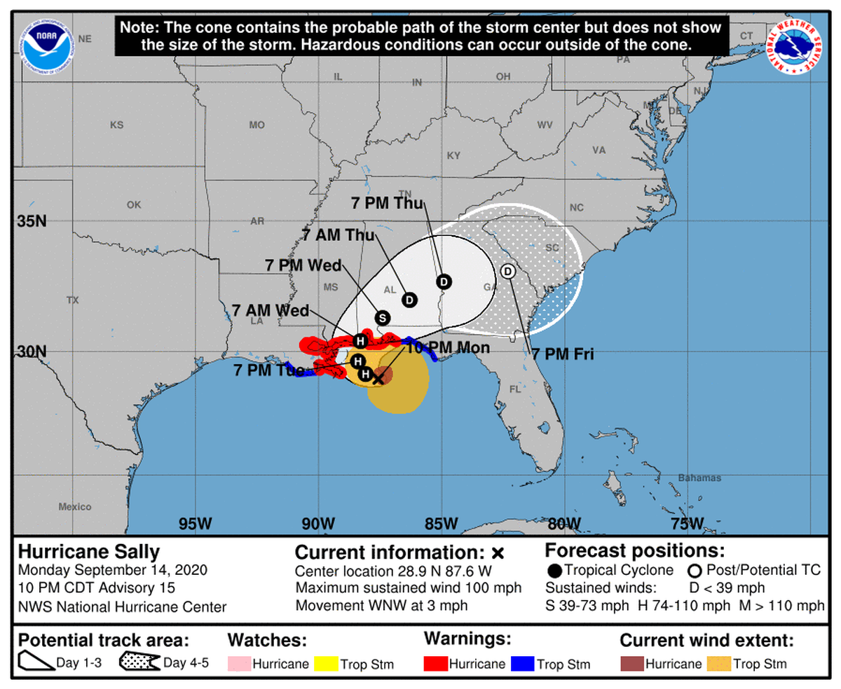
The Category 2 storm’s winds are strong, but Sally’s steering currents are expected to be weak as she meanders northward Tuesday morning in the Gulf of Mexico, her target anywhere from southeast Louisiana to northwest Florida.
The National Hurricane Center, taking spaghetti models into account, on Monday night marked her entry on land late Tuesday or early Wednesday at the Mississippi-Alabama line. But the projected path is only a line on a map at this point.
“There continues to be a significant amount of uncertainty on exactly where and when Sally turns northward and makes landfall, with model solutions ranging from a landfall on the Florida panhandle to a landfall in extreme southeastern Louisiana,” the NHC said.
“It should be emphasized that it is always challenging to forecast the track of hurricanes in weak steering currents, and in Sally’s case the weak steering is occurring very near land.”
Sally’s creeping progress — 3 mph with the last NHC update Monday night — drew out the waiting game.
Low shear and warm Gulf waters allowed for short-term intensification Monday evening, as the eyewall closed off, but Hurricane Sally is expected Tuesday to confront westerly shear and colder shelf waters rising toward the Gulf’s surface.
The hurricane had 100 mph winds Monday night and was expected to deluge the north central Gulf Coast with storm surge and flash-flooding from heavy rainfall. Sally is expected to move inland Wednesday.
This story was originally published September 14, 2020 at 10:55 PM.