Rivers will flood as storms dump rain across the MS Coast. See forecast for your county.
Most areas of the Mississippi Coast are under weather advisories on Thursday as thunderstorms pass through the Gulf Coast region.
A flood watch is in effect for Hancock, Harrison and Jackson counties as well as parts of Louisiana until 7 p.m. Thursday.
Here’s what you need to know for your county.
Harrison County
A flash flood warning is in effect for east/central Harrison County until 4:45 p.m. Thursday, according to the National Weather Service. “Flash flooding of small creeks and streams, urban areas, highways, streets and underpasses as well as other poor drainage and low-lying areas” is expected.
The areas effected are Gulfport, Biloxi, Ocean Springs, St. Martin, D’iberville, Latimer, Gulf Hills and Gulf Park Estates. The advisory also includes Interstate 10 between mile markers 37 and 56 and Interstate 110 near mile marker 1 and between mile markers 3 and 4.
All of Harrison County is also currently under a flood advisory until 4 p.m. Thursday.
According to the National Weather Service, “minor flooding is ongoing or expected to begin shortly. Some locations that will experience flooding include Gulfport, Biloxi, St. Martin, D’Iberville, Lyman, Latimer and Saucier.”
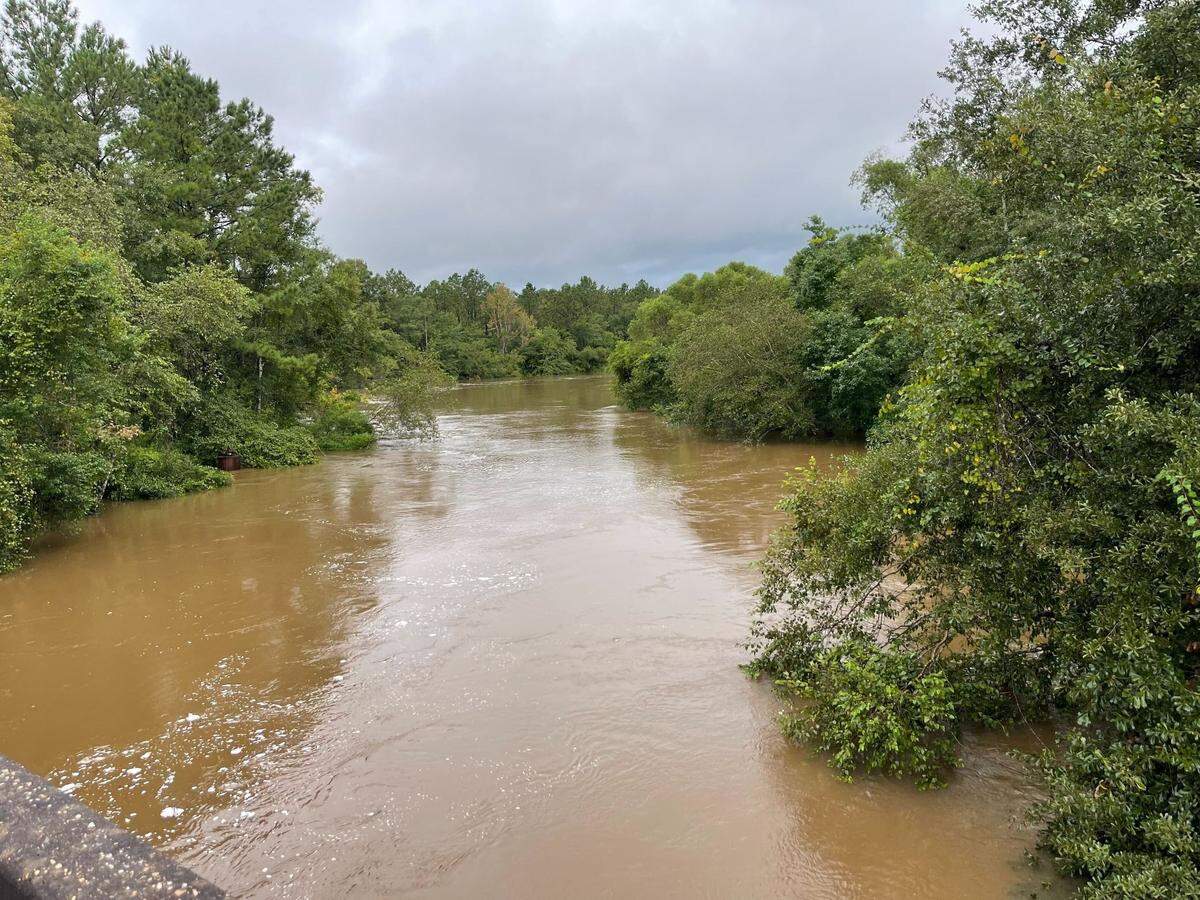
Rob Dambrino, the deputy director for emergency management in Harrison County, said several rivers could reach high levels on Friday and Saturday and flood warnings for the rivers are in effect until Saturday. Here are the latest river readings in Harrison County:
- The Biloxi River measured 14.4 feet at 2:45 p.m. on Thursday. It is forecast to crest at 16.5 feet early Friday morning. The flood stage is 12 feet for the Biloxi River.
- The Tchoutacabouffa River measured 8.2 feet at 2:30 p.m. on Thursday and is forecast to reach 9.5 feet by Friday evening. The flood stage is 8 feet for this river.
- The Wolf River measured 6 feet at 2:45 p.m. on Thursday and is forecast to get up to 9 feet on Friday afternoon. The flood stage is 8 feet.
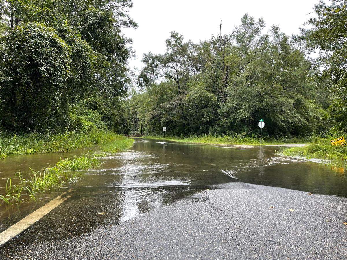
The Biloxi River was already swollen Thursday, and water had taken over parts of River Road off Three Rivers Road. The residential area is waterfront and used to flooding. River Road will likely close when the water gets higher.
Jackson County
A flash flood advisory is in effect for Jackson County until 4:45 p.m.
Between 1.5 and 2.5 inches of rain have fallen since 10:10 a.m with heavy rain still occurring, according to the National Weather Service.
The National Weather service advises that “flash flooding of small creeks and streams, urban areas, highways, streets and underpasses as well as other poor drainage and low-lying areas [could occur]. Some locations that will experience flash flooding include Ocean Springs, Moss Point, Gautier, Hickory Hills and Gulf Park Estates.”
A flood advisory is in effect until 1 p.m.
“Minor flooding is ongoing or expected to begin shortly. Some locations that will experience flooding include... Moss Point, Escatawpa, Gautier, Hickory Hills, Vancleave, Helena, Wade, Big Point and Latimer.”
The rest area near the Franklin Road exit on Interstate 10 is closed Thursday due to flooding.
George County
A river flood warning will be in effect starting at 10 p.m. Friday for areas in Jackson and George Counties affected by the Pascagoula River.
According to the National Weather Service, the Pascagoula River, which was measured in the Merrill community, was at 18.5 feet on Thursday at 8:15 a.m. The flood stage is at 22 feet, which the river is expected to meet on Friday evening and will keep rising to 23.4 feet by Tuesday morning.
The National Weather Service advises that at 18.5 feet, water can cover roads at Smith’s Fish Camp in Southern George County. At 20 feet, water can cover the main road at Plum Bluff in southern George County. After 22 feet, water could approach homes in west Merrill and at 23.5 feet, water could reach under homes in Plum Bluff Estates and flood streets in Merrill.
Hancock County
According to Brian Adam, Hancock County’s Emergency Management Director, as of Thursday morning, Hancock county is expected to get 3 to 6 inches of rain. Hancock County is currently under a flood watch until 7 p.m Thursday evening.
No tidal issues are expected at this time, Adam said.
This story was originally published August 25, 2022 at 12:54 PM.