Flash flood watch issued for South Mississippi
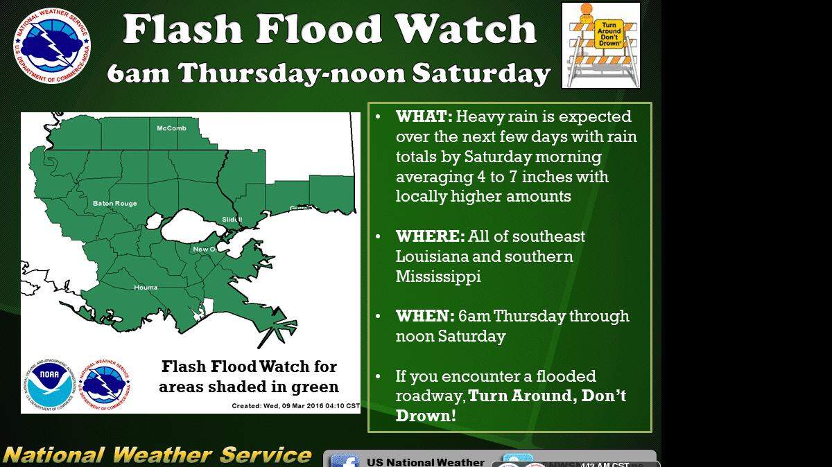
The National Weather Service has issued a flash flood watch for South Mississippi from Thursday morning through Saturday morning.
The large storm system bringing heavy rains and damage across the southern United States is now expected to reach South Mississippi on Thursday. The storm caused flooding and property damage in Texas, Arkansas and Oklahoma on Tuesday after wreaking havoc in California earlier this week. Today the heavy rains have flooded homes over northwest Louisiana.
On the Gulf Coast, 4 to 6 inches of rain are anticipated with locally higher amounts approaching and possibly exceeding 8 inches.
The slow-moving storm front should reach South Mississippi on Thursday night. The heaviest rains are expected Friday into early Saturday. The skies should clear by Saturday evening.
There is a marginal risk of severe weather, with the greatest concerns being strong thunderstorms, damaging winds and possibility of an isolated tornado.
The weather service also expects to issue a flash-flood watch over the next few days.
A wind advisory -- when sustained winds of 26 to 39 mph are expected for an hour or longer -- has been issued for all of South Mississippi until at least 6 p.m. Thursday.
Small-craft advisory conditions will continue, meaning wind speeds of 20 to 33 knots are expected to produce hazardous wave conditions to small craft. Gale-force winds -- 34 to 47 knots -- are also possible.
High winds could push tides up to 2 feet above normal, and the weather service has issued a coastal flooding advisory until 6 p.m. Thursday. Expect minor flooding of low-lying coastal roads and areas normally subject to coastal flooding.
Temperatures are predicted to stay warm, with highs staying in the 70s through the weekend.
This story was originally published March 8, 2016 at 7:46 PM.