A low in the Gulf could bring bad weather to the MS Coast. Here’s the forecast.
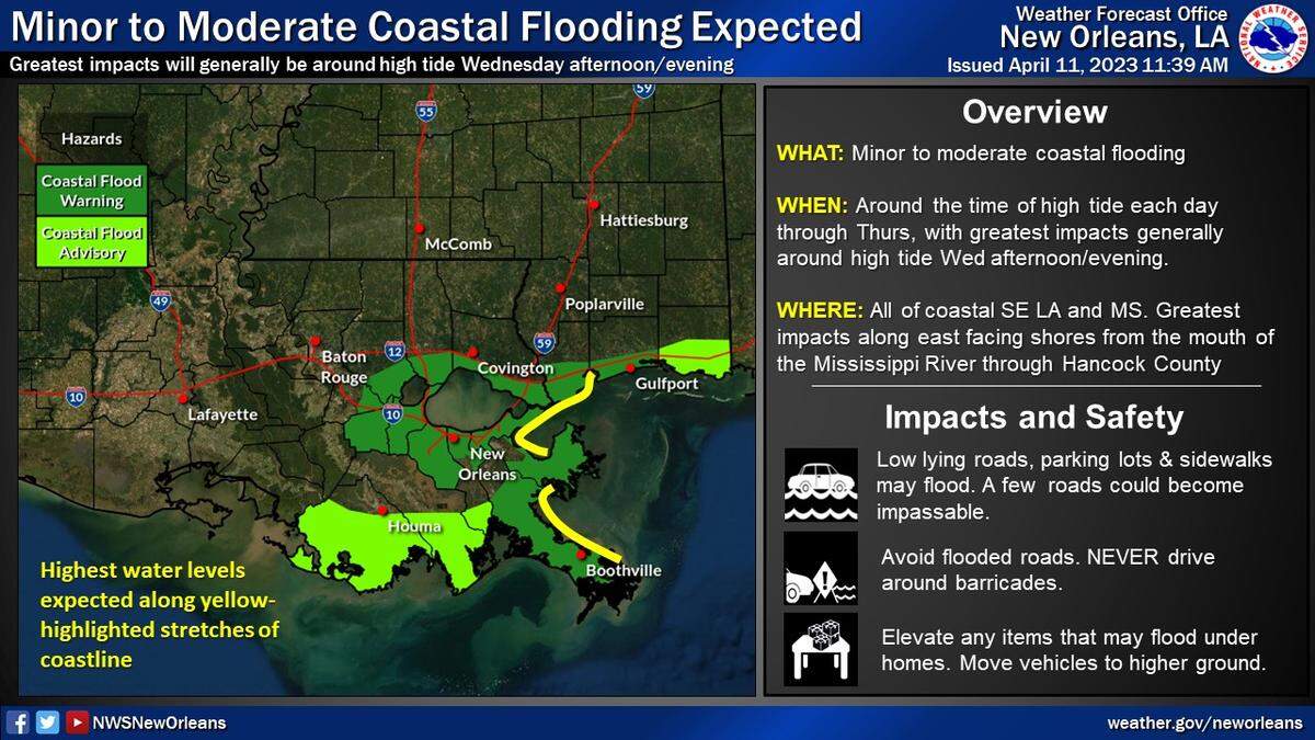
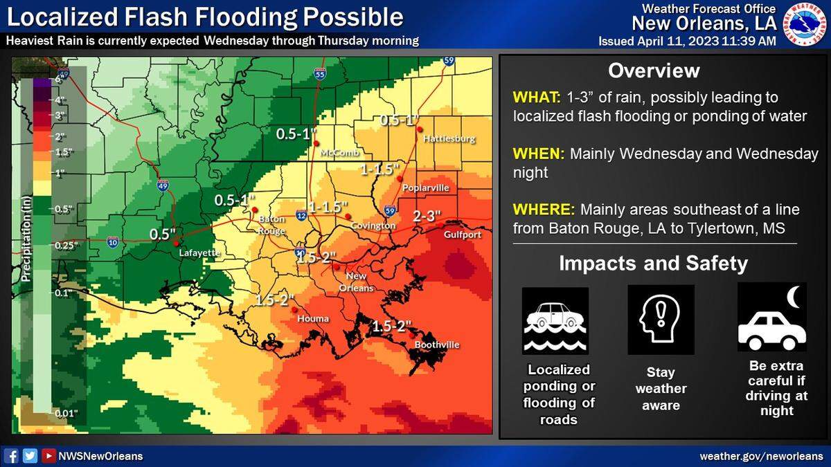
Coastal flooding is expected in South Mississippi this week and possibly heavy rain depending on the track of a Gulf low, the National Weather Service in New Orleans reports Tuesday.
NWS said a surface low will develop this week in the Gulf.
The National Hurricane Center doesn’t show any tropical development over the next five days.
“Where the low develops and tracks will have significant implications on the expected impacts this week,” the post says. “At this time main concerns are locally heavy rain, widespread marine impacts and significant coastal flooding concerns.”
Hancock County reports Tuesday evening that 96 roads and streets throughout the county already were seeing minor flooding but were passable.
The greatest impacts in South Mississippi are expected to be:
▪ Coastal flooding — Water levels could reach three feet above normal high tide. The highest water is expected during high tide Wednesday afternoon and evening along east facing shores from the mouth of the Mississippi River through Hancock County. In Waveland, the peak is expected at 7 p.m. Wednesday.
▪ Possibly heavy rain — The current forecast is for 1-3 inches of rain. Locally heavy rainfall and flash flooding is possible across the area, but even a small change in the low track will mean the difference in excessive rainfall or not much.
▪ Gusty winds — There is a low to medium (20-40%) chance of sustained gale winds and a medium to high (50-90%) chance of at least a few gale force gusts over the coastal waters.
▪ Small craft advisory — Hazardous winds and seas are expected and a Small Craft Advisory is in effect for all coastal waters of Southeast Louisiana and Mississippi through at least Thursday morning.
Residents should stay weather aware, the NWS said, avoid flooded roadways and consider moving household objects and vehicles to higher ground if they live in a particularly flood prone area.
This story was originally published April 11, 2023 at 4:19 PM.