
Storms could bring strong winds, flash flooding to South MS. What to know
Thunderstorms on Friday could threaten South Mississippi with possible flooding, hail and gusting winds, forecasters said.
The National Weather Service said the biggest threat is wind that could blow in gusts over 60 mph. Isolated flash flooding, quarter-size hail and a few tornadoes are possible.
Forecasters said the storms would arrive in several rounds and strengthen through the afternoon and evening. Rain is expected to continue through Saturday morning.
It is unclear where the strongest storms will hit. But the National Weather Service said much of Hancock County and northwestern Harrison County are under a slight risk of severe storms. The risk is lower across the rest of the Mississippi Coast.
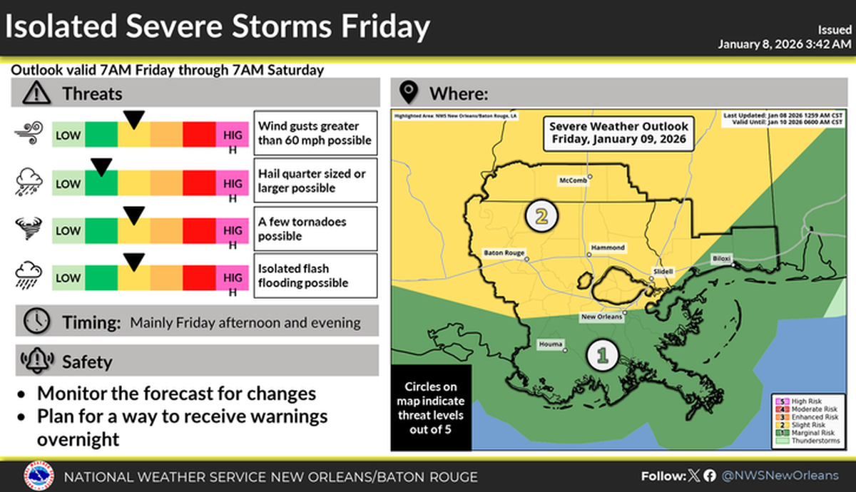
Hancock and Pearl River counties are under a flood watch through Saturday morning. Forecasters warned rain could flood rivers, creeks, streams and other low-lying areas. About 2 to 4 inches of rain is forecast, and some areas could see greater totals.
Cooler weather will follow the storms. By Sunday night, temperatures could drop to 35 degrees in Gulfport. High temperatures next week are expected to fall in the 50s.