
Coldest weather of winter is heading for South Mississippi. Could we really see snow?
The coldest weather of winter will invade South Mississippi next week with frigid morning temperatures that could freeze pipes, hurt plants and bring the small but still possible risk of snow or ice.
Forecasters are confident that well-below normal temperatures will reach the Mississippi Coast Monday night through Wednesday morning. Morning temperatures next week will probably be in the lower to mid 20s, said Hannah Lisney, a meteorologist for the National Weather Service in Slidell.
“There’s just going to be some very cold air,” she said.
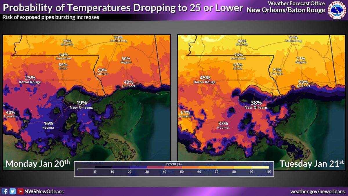
Forecasts are still uncertain several days out, and Lisney said it was too early to know whether the Coast will get snow.
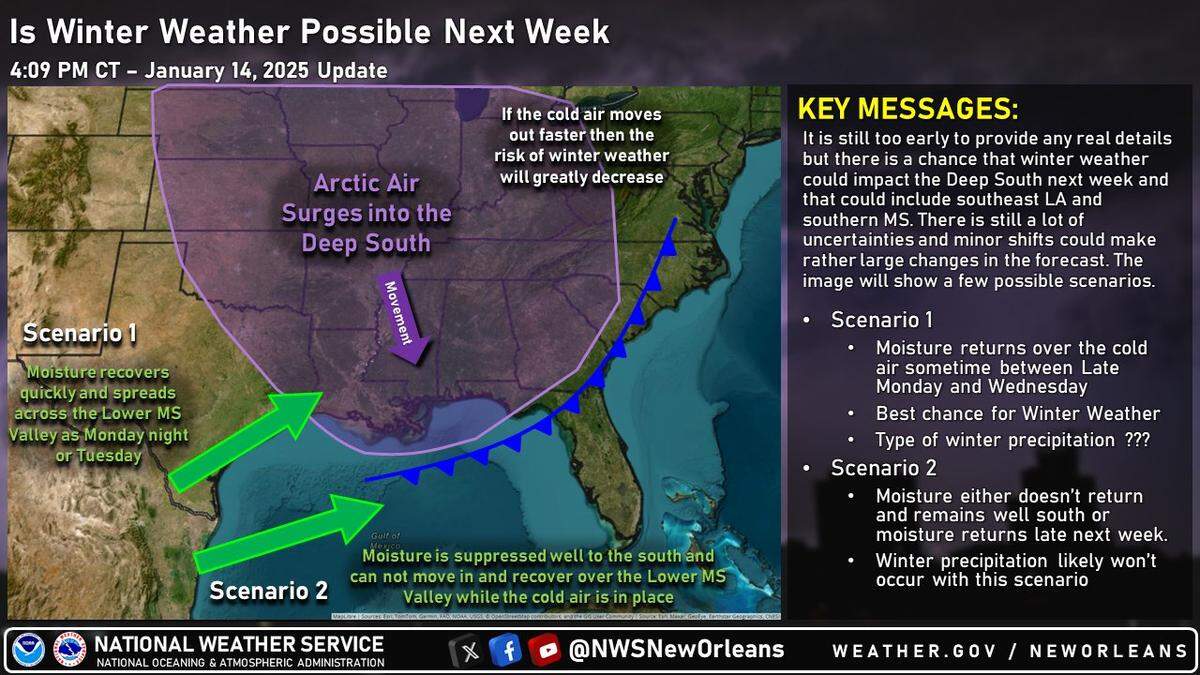
“We don’t even know if we get winter precipitation if it would be snow,” Lisney said. “It could be ice. It could be sleet. It could be a mix of all three. We have no idea at this point.”
It depends on timing. A cold front from the north will bring dry air behind it next week. Forecasters are still waiting to see if humid air from the Gulf of Mexico sticks around long enough to create rain, or if dry air that follows the cold front will send any precipitation over open water.
Lisney said the more immediate worry is the cold. She said residents should start preparing to cover pipes before temperatures hit freezing.
Several freezes are common each winter in South Mississippi, and next week’s cold front will be the second this year. Arctic air also plunged the Coast into morning freezes for three days in early January.
Any snow next week would be the first the region has seen in several years. Lisney said the last time it snowed in South Mississippi was December 2017, when the National Weather Service recorded 1.5 inches in Wiggins and 4 inches in Poplarville.
This story was originally published January 15, 2025 at 1:16 PM.