Tropical system will dump rain on the Mississippi Coast for days. Here’s the forecast.
It’s likely going to be a wet week as a tropical system in the Gulf is expected to dump rain across the Coast for days.
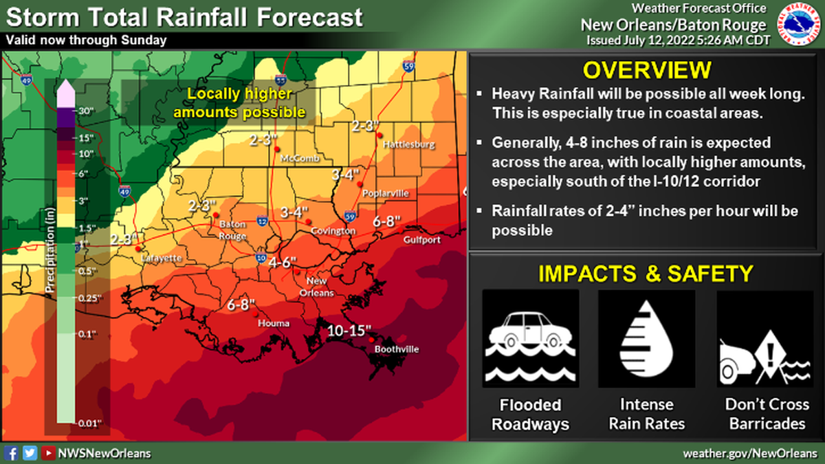
Heavy rainfall is expected “at least through Sunday morning” across portions of Southeast Louisiana and South Mississippi, according to the National Weather Service.
Rainfall totals will be highest south of Interstate 10 on the Coast, the NWS said.
Up to 8 inches of rain is possible in Hancock, Harrison and Jackson counties through the rest of the week. Rainfall rates of 2 inches to 4 inches per hour is also possible.
The greatest risk of flash flooding for the Gulfport-Biloxi area will be Wednesday, Thursday and Friday, said Matt Stratton, Harrison County emergency manager.
The tropical system has a 30% chance of development over the next five days, according to the National Hurricane Center in Miami.
“The surface trough is expected to meander near the northern Gulf coast through the end of the week, but gradual development will only be possible if it remains over water during that time,” the NHC said in its 1 p.m. update.
This story was originally published July 12, 2022 at 3:58 PM.