At least 2 tornadoes confirmed on Mississippi Coast during night of severe weather
Severe weather capable of producing tornadoes, hail and high winds is headed toward South Mississippi. Here are the latest updates for the Coast, other parts of the state and Louisiana.
11:30 p.m.
Tornado and severe thunderstorm warnings expired on the Coast as a strong line of thunderstorms that produced at least two tornadoes — one confirmed in Hancock county, the other in Jackson county — moved away from South Mississippi.
More than 2,000 Coast residents were without power at about 11:30 p.m. Wednesday.
10:30 p.m.
The National Weather Service has issued a severe thunderstorm warning for Jackson County until 11 p.m. as a tornado moved through parts of the county — including the Vancleave area — starting around 9:50 p.m.
10:10 p.m.
Thousands of residents in Harrison and Jackson counties are without power as a strong line of storms that has produced at least two tornadoes in South Mississippi moves through the area.
A tornado was confirmed at 9:50 p.m. in the Vancleave area, according to the National Weather Service.
More than 2,200 residents in the Gulfport-Biloxi metro are without power after the storms went through Harrison County, according to Mississippi Power’s outage map.
About 1,200 Singing River Electric customers in Jackson, George and Greene counties were without power at 10:10 p.m.
Mississippi Power’s map often gives information on when power is expected to be restored.
You can check outage maps here.
9:50 p.m.
The National Weather Service Tweeted at 9:49 that a tornado has been confirmed in Jackson County near Vancleave heading west toward Wade and Hurley.
A tornado warning had just been issued for that area by NWS a few minutes prior.
Jackson County remains under tornado warning until 10:45 p.m.
9:15 p.m.
A severe thunderstorm warning is in effect until 9:45 p.m. for much of Harrison County and parts of Hancock and Jackson counties, the National Weather Service tweeted.
Cities include Diamondhead, Long Beach, Gulfport and Gulf Hills.
There is also a special marine warning for the coastal waters from Pascagoula to Stake Island, Chandeleur Sound, Mississippi Sound, Breton Sound and Lake Borgne until 10:00 p.m.
At least 3,000 were without power at 9:15 p.m., with a strong concentration in Stone County.
Hail was confirmed by the NWS at 9:02 p.m.
8:45 p.m.
The National Weather Service confirmed a tornado-formed storm in the Pearlington area at about 8:45 p.m. The system is quickly moving east northeast toward Waveland, Diamondhead and north Hancock County.
The storm system was on U.S. 90 near the Hancock County jail and Bayside Park at 8:43 p.m.
“Seek Shelter now!!!” the NWS tweeted.
8:30 p.m
A tornado warning has been issued for parts of Hancock County until 9 p.m. as a strong line of storms moves toward the Coast from Louisiana.
The National Weather Service said that Waveland, Kiln and Pearlington are included in the warning.
The Weather Channel says the system is moving fast, about 60 mph.
Large strikes of lightning were reported in Waveland. Hail is also possible and has been reported in the Slidell area.
Residents in the areas near Waveland and Pearlington should take cover and be weather aware as the storm cell approached quickly at 8:25 p.m.
8 p.m.
A possible tornado was spotted on the ground close to Fountainbleau State Park near Interstate 12 in St. Tammany Parish, Louisiana, according to Weather Channel meteorologist Scott Pilie’. That line of storms is moving toward north Hancock County and southern Pearl River County.
7 p.m.
South Mississippi is now under a tornado watch until 4 a.m. Thursday.
The National Weather Service issued the watch for four counties about 6:40 p.m. Wednesday night.
The counties are Harrison, Hancock, Jackson and Pearl River.
Several cities are also included. Those are Bay St. Louis, Crossroads, Diamondhead, Gautier, Gulfport, McNeil, Moss Point, Ocean Springs, Pascagoula, Picayune, St. Martin and Waveland.
The city of Picayune also has a severe thunderstorm warning.
5:30 p.m.
In a Facebook post, the National Weather Service in Jackson confirmed a tornado just west of the Jackson metro. State Sen. Brice Wiggins, who is from Pascagoula, posted a selfie on Twitter showing state senators sheltering in the basement of the state capitol building during tornado warnings in the area.
4:30 p.m.
The worst part of the storm system should hit Harrison County, including Biloxi and Gulfport, and Hancock County from 8 p.m. to 10 p.m. Wednesday, according to Matt Stratton, director of emergency management for the county. Jackson County should prepare for the worst effects after that, in the 10 p.m. to 1 a.m. range.
Almost all of the Coast faces a moderate risk for severe weather capable of producing tornadoes, hail and winds of up to 70 mph.
The high wind warning and coastal flood advisory remains in effect until early Thursday morning. Two shelters are open in Hancock County, according to MEMA.
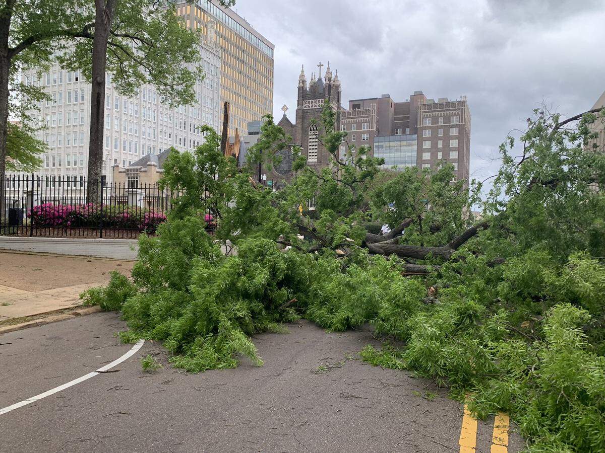
More than 1,000 were without power in central Mississippi after part of the storm system moved through, according to Mississippi Power’s outage map. Hattiesburg Mayor Toby Barker said four trees had already fallen over roadways in the city, and they expect more severe weather into the night. He urged residents to get home, stay safe and be weather aware.
A traffic light has also fallen, according to Hattiesburg Police Department on Twitter.
Gov. Tate Reeves said a large tree has fallen on the grounds of the governor’s mansion in downtown Jackson.
“Be safe friends,” he tweeted.
A large swath of Louisiana was under a severe thunderstorm warning at 4:30 Wednesday as the storm system moved through the area, the NWS tweeted. Much of the southern part of the state is under a tornado watch until 9 p.m.
This story was originally published March 30, 2022 at 4:51 PM.