
Gonzalo expected to reach hurricane strength. Gulf storm system could become Hanna.
A tropical storm in the Atlantic could strengthen to a hurricane by the end of the week, according to the National Hurricane Center.
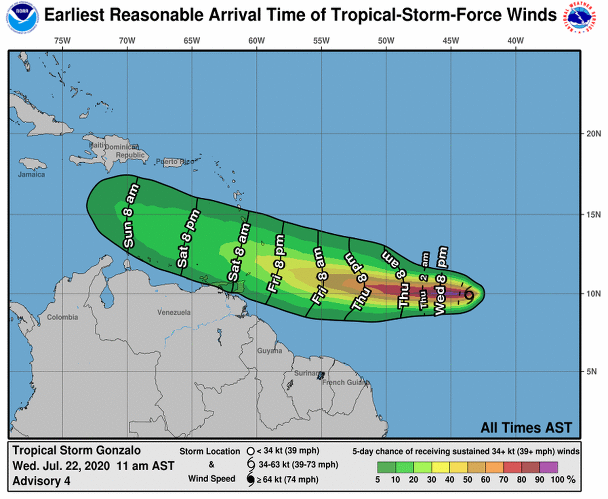
Forecasters say Tropical Storm Gonzalo could bring high winds and heavy rain as it moves over the southern Windward Islands this weekend. Tropical storm-force winds could arrive in the region as early as Friday, forecasts show.
The system, which formed between the Lesser Antilles and west coast of Africa, is currently moving west-northwest at about 12 mph and packing 45-mph maximum-force winds.
Minimum central pressure is 1003 mb or 29 inches, meaning there’s low risk of a storm surge over 5 feet, according to the updated forecast. Tropical Storm Gonzalo will continue to strengthen as it crosses the Atlantic and is expected to become a hurricane by Thursday.
So what does this mean for the Mississippi Gulf Coast? Forecasters aren’t sure, but the risk remains low. Little to no impact is expected in the coming days.
“While it’s too soon to determine the magnitude and timing of those impacts, interests in the southern Windward Islands should monitor the progress of Gonzalo,” the NHC states.
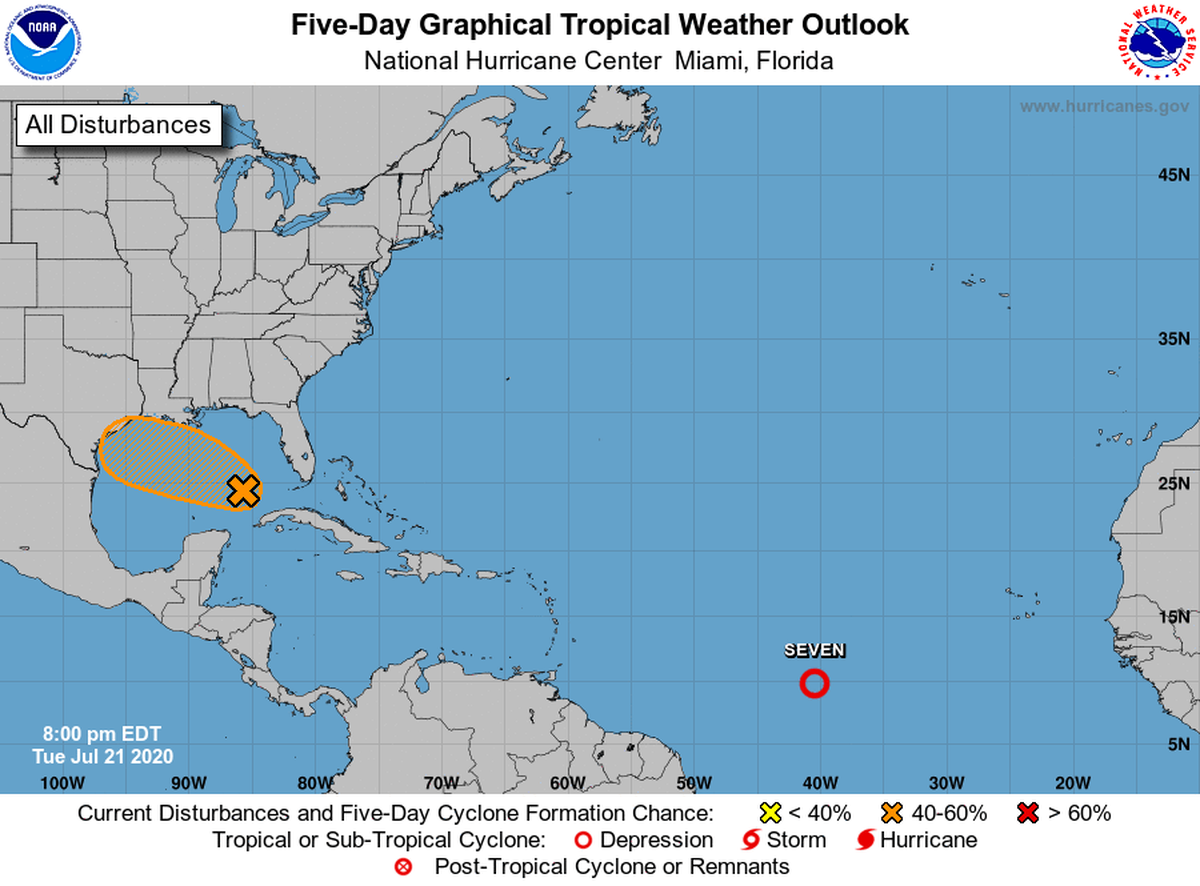
While Gonzalo isn’t an immediate threat, forecasters are still eyeing a tropical disturbance that moved into the Gulf of Mexico late Tuesday. That system now has a 50% percent chance of developing into a storm in the next five days, per the National Weather Service.
The chance of development is slightly lower over the next two days, the forecast shows. If it strengthens to a tropical storm, it will be named Hanna.
Regardless of how the system develops, Mississippi, Texas and the rest of the Gulf Coast can expect to see higher chances of rain through the rest of the week along with “dangerous lightning and higher than normal tides” and coast flooding, the weather service said.
This story was originally published July 22, 2020 at 12:12 PM.