
Saharan dust cloud to bring haze, vibrant sunsets to Mississippi. Here’s the forecast
A dust cloud from the Sahara Desert is on its way to Mississippi and could arrive by the weekend, weather forecasts show.
The phenomenon known as the Saharan Air Layer is expected to bring hazy skies but beautiful sunsets as it completes its 5,000 mile journey across the Atlantic and parts of the southeastern U.S. this week. As of Wednesday, the mass of dusty, dry air blanketed much of the Gulf of Mexico and Caribbean, according to a National Weather Service forecast map.
Experts say the potential for dust could last into early next week.
The cloud is kicked up and carried thousands of miles westward during the warmer months each year, but this plume in particular is the largest meteorologists have seen in decades. Its high dust concentration is nothing to sneeze at either.
“This year’s a little more potent, but I think there’s a little more attention on it too, with just all the craziness that 2020 has already unfolded and allowed,” said Rachel Coulter, meteorologist at news station WLBT in Jackson.
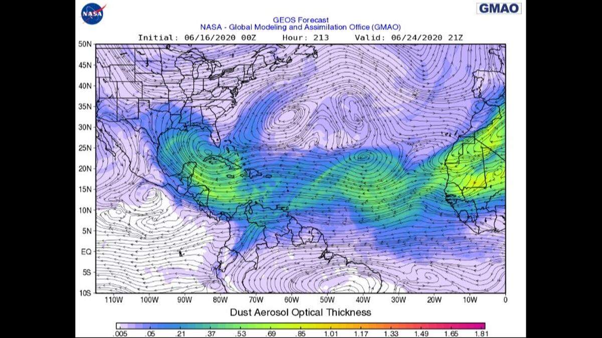
The system is already at Mississippi’s doorstep and carrying as much as 182 million tons of sand from the Sahara, said Coulter, citing estimates from NASA.
“If you were to compare it to semi trucks ... that’s roughly 689,000 semi trucks filled with dust,” she added, WLBT reported.
The hazy conditions could prove problematic for allergy sufferers, causing sneezing, watery eyes and other symptoms. Meteorologist Frank Billingsley at KPRC in Houston urged allergy sufferers to “be prepared.”
“Sinus sufferers hate this dust and I don’t blame them,” Billingsley wrote in a weather blog Monday. “You can’t really ‘see’ it as the dust is usually pretty fine by the time it gets here, but itchy eyes, noses and throats are all possible if you are sensitive to it.”
It’s not all bad news, however. The Saharan Air Layer, which coincides with the Atlantic hurricane season, has been known to keep tropical storms from forming — which means more sunshine. Warm, dry air from the plume working together with high atmospheric pressure could also lessen the chance for thunderstorms in the Gulf Coast this weekend, according to the NWS in Fort Worth, Texas.
The cloud is expected to bring breathtaking sunsets to parts of the Gulf and the rest of the southeastern U.S., experts say.
Forecasts show the plume could continue traveling far north and east of the Ohio Valley and mid-Atlantic through the weekend.